Area Overview for Spondon Ward
Photos of Spondon Ward


Area Information
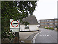
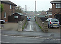
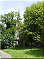
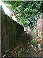
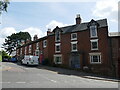
Living in Spondon Ward offers a distinct suburban experience on the eastern outskirts of Derby. This district forms part of the Derby unitary authority in Derbyshire, situated within the East Midlands of England. The ward covers an area of 8.0 km² and currently houses a population of 2,975 residents. Originally a historic village and township near the Derby and Nottingham railway, Spondon Ward is now fully integrated into the greater Derby City conurbation. You might find yourself walking past St Werburgh's Church, a decorated English building featuring a prominent tower and spire, which anchors the local history. The area was first recorded as Spondune in the Domesday Book of 1086, a name derived from Old English roots suggesting a hill used for wood-chips or shingles. Archaeological evidence confirms habitation during Roman times, proving deep historical roots. While the area was once a separate parish including Stanley chapelry, it now operates as a modern borough unitary ward. The community centres around quiet residential streets rather than high-rise developments. Homes in Spondon Ward typically reflect a settled atmosphere, away from the immediate city centre but close enough to benefit from established local amenities. The ward continues to evolve while maintaining its connection to the railway heritage that once served its residents.
- Area Type
- District Borough Unitary Ward
- Area Size
- 8.0 km²
- Population
- 2975
- Population Density
- 373 people/km²
Demographics
The community profile of Spondon Ward presents a clear picture of a settled, older demographic. With a median age of 70, the population skews significantly towards retirement age. This age shift defines the daily rhythm of the neighbourhood, where residents likely prioritise local leisure and family proximity over urban commuting. Despite the older population, the ward maintains a strong sense of stability through high rates of home ownership. Approximately 75% of households in Spondon Ward own their homes outright or with a mortgage. This high ownership rate suggests long-term residents who have invested in properties within the 8.0 km² boundary over many years. The household composition aligns with this demographic, featuring families empty-nesters rather than transient young professionals. You will find that the accommodation types are dominated by traditional structures, though specific breakdowns by property style are not detailed in current records. The ethnic and religious diversity data remains general, but the overall picture is one of homogeneity driven by age and tenure. Living in Spondon Ward means joining a community where neighbours have likely known one another for decades. The low population density of 373 people per km² ensures that residents do not feel crowded by their peers. This demographic stability is crucial for those seeking a predictable environment for retirement living.
Household Size
Accommodation Type
Tenure
Ethnic Group
Religion
Household Composition
Age
Household Deprivation
NS-SEC
Explore more demographic insights in this area
Go to Demographics tabPlanning
Planning Constraints
- Flood RiskPremium
- Ramsar Wetland SitesPremium
- Area of Outstanding Natural BeautyPremium
- Protected Nature ReservePremium
- Protected WoodlandPremium
- Crime RiskPremium