Area Overview for Spinney Hills Ward
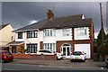
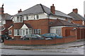
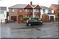
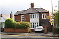
Photos of Spinney Hills Ward
Area Information
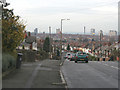
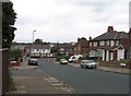
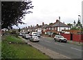
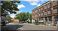
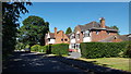
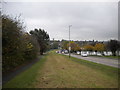
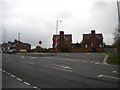
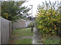
Spinney Hills Ward is a quiet urban residential district within the east of Leicester City Centre. This specific ward covers an area of just 1.4 km², yet it holds a significant place in Leicester's history. The location forms part of the broader Highfields area and sits within the East Midlands region. You will find dense terraced housing developed primarily between the late 19th and early 20th centuries. The defining landmark is Spinney Hill Park, a 36-acre conservation area containing mature trees and a fountain. This park was purchased in 1886 from Colonel Burnaby and opened on 24 August 1886. Surrounding streets like St Saviour's Road, developed by Arthur Wakerley in 1887, and the grid of back-of-pavement houses define the current character. The area transitioned from rural farmland in Evington parish to a centre for hosiery and shoe factories during the rapid industrial expansion of the 1880s. You are looking at a neighbourhood where historical industry once integrated directly into the residential streets. The atmosphere reflects this multicultural and industrial past, including the presence of a synagogue established in 1898. Living in Spinney Hills Ward means inhabiting a space where late Victorian housing meets late 20th-century community activism, such as the anti-racism carnivals held in 1977 and 1978.
- Area Type
- District Borough Unitary Ward
- Area Size
- 1.4 km²
- Population
- Not available
- Population Density
- Not available
Demographics
The community in Spinney Hills Ward is dominated by older residents. The median age here is 70, indicating a population skewed significantly towards those requiring retirement or care housing. This demographic profile suggests a neighbourhood where daily life revolved around activities suitable for seniors rather than young families or students. Historical records show the area as a working-class industrial district, but current figures reflect a later shift in population composition. Home ownership is strong, with 59% of residents owning their properties outright or with a mortgage. This level of ownership suggests long-term residents who have stayed through various cycles of economic change over the decades. The ward has no recorded data regarding specific household composition breakdowns between families and singles, nor data on predominant ethnic groups or religious affiliations. You must interpret this silence by focusing on the clear age statistic. A median age of 70 fundamentally shapes the area's services and social environment. While specific figures on deprivation are not provided, the low crime risk level indicates a stable environment for this senior demographic. The area's character reflects this stability, defined more by the continuity of long-term residents than transient population turnover.
Household Size
Accommodation Type
Tenure
Ethnic Group
Religion
Household Composition
Age
Household Deprivation
NS-SEC
Explore more demographic insights in this area
Go to Demographics tabPlanning
Planning Constraints
- Flood RiskPremium
- Ramsar Wetland SitesPremium
- Area of Outstanding Natural BeautyPremium
- Protected Nature ReservePremium
- Protected WoodlandPremium
- Crime RiskPremium