Area Overview for Spalding St. Mary's Ward
Photos of Spalding St. Mary's Ward

Area Information
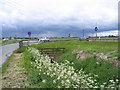
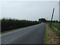
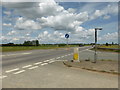
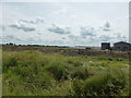
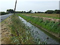
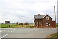
Living in Spalding St Mary's Ward offers a connection to England's East Midlands defined by its historic market town status and the presence of the River Welland. This electoral ward sits within the South Holland District and spans 12.1 square kilometres. The community centre involves postal codes primarily operating under the PE11 designation, which anchors residents near the town's railway station. Living in this ward places you within a ground of 1,196 hectares that represents 1.61 per cent of the broader South Holland District. The area retains significance as a local rail hub, facilitating movement for those commuting or travelling beyond the immediate neighbourhood. The ward functions as a distinct part of the market town of Spalding, where the modern A16 bypass diverts heavy traffic from the central areas. This was achieved through the Spalding-Sutterton Improvement project that opened in 1995. The former main route through the town has been renumbered as the A1175. Alternatively, the A1073 provides a direct link for residents heading towards Peterborough. Daily life here relies on established road networks that separate through traffic from local needs. You will find the ward centred around coordinates approximately 52.7678°N, 0.1457°W. This positioning makes the area a settled part of the wider region rather than a commuter fringe. The character of the ward is shaped by these physical features which define the boundaries of life for you and your neighbours.
- Area Type
- District Borough Unitary Ward
- Area Size
- 12.1 km²
- Population
- Not available
- Population Density
- Not available
Demographics
Spalding St Mary's Ward has a community profile that suggests a settled population with significant experience of the area. The median age stands at 70 years, which indicates an older demographic where many residents have chosen this location for their long-term living arrangements. This average resident age of 70 contrasts with the mean resident age of 43 years recorded for the wider ward overview in 2021. This data point reflects the diverse age structures found across the different parts of the ward itself. Home ownership is a dominant feature of this neighbourhood. Exactly 59 per cent of households own their property free of mortgage. You will find fewer tenants renting their homes compared to areas built for student living or young professionals. The total population recorded in the latest census figures is 3,965 people. This population resides within the specific boundaries that include the PE11 postcodes. The composition of households and the predominant ethnic group statistics are part of the official total for the ward. Religion data is also recorded as a total figure for the community. Understanding these demographics helps you gauge the pace of daily life. The age profile often aligns with quiet streets rather than busy commercial zones. The high ownership rate suggests stability, meaning neighbours may be willing to offer local knowledge. You can expect a community where the younger generation has significant family connections or depends on the area for retirement purposes. The environment supports a lifestyle where residents value stability over rapid change.
Household Size
Accommodation Type
Tenure
Ethnic Group
Religion
Household Composition
Age
Household Deprivation
NS-SEC
Explore more demographic insights in this area
Go to Demographics tabPlanning
Planning Constraints
- Flood RiskPremium
- Ramsar Wetland SitesPremium
- Area of Outstanding Natural BeautyPremium
- Protected Nature ReservePremium
- Protected WoodlandPremium