Area Overview for Spalding Monks House Ward
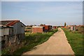
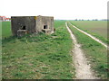
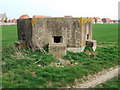
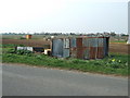
Photos of Spalding Monks House Ward


Area Information
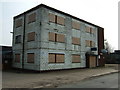
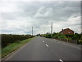
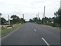
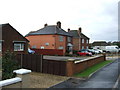
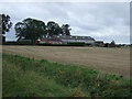
Spalding Monks House Ward serves as an electoral ward within South Holland district, covering a specific section of the market town on the River Welland. This area spans 6.3 km² and represents a settled environment where daily life revolves around local market town infrastructure. The ward sits at approximately 52.7753°N, -0.1863°W, placing it near the wider town coordinates while maintaining its own distinct identity. Living in Spalding Monks House Ward means accessing the amenities of Spalding without the sprawling distances of a rural village. You will find yourself surrounded by historic features, including Monk's House, a listed building that stands as a notable landmark within the ward boundaries. This ward operates under the PE11 postcode area, linking residency to standard postal services used across the surrounding regions. The geography defines a compact community where proximity to the River Welland influences the local character. Prospective residents join a district unitary system that offers established governance structures for this specific part of Lincolnshire. The ward provides a focused living experience, distinct from the broader municipal area yet fully integrated into the East Midlands region. Your immediate surroundings reflect a blend of residential history and modern postal utility, creating a defined space for home life.
- Area Type
- District Borough Unitary Ward
- Area Size
- 6.3 km²
- Population
- Not available
- Population Density
- Not available
Demographics
The community profile of Spalding Monks House Ward reveals a distinct age demographic with a median age of 70. Most homeowners within the ward belong to this older age bracket, shaping the daily rhythm of the neighbourhood. Home ownership stands at a high level of 69%, indicating that the majority of residents own their properties outright or through mortgages rather than renting. You are likely to encounter a population where long-term settlement is common, as evidenced by the high ownership percentage. The ward does not specify most common age ranges beyond the total age count, but the median figure suggests a mature population dynamic. Accommodation types and predominant ethnic group data are presented as totals, reflecting the comprehensive nature of the ward's demographic record. Religion statistics are also recorded as total figures, without breaking down specific faith communities in the provided data. This demographic picture paints a scene of stability, where residents have deep roots in Spalding Monks House Ward. The area functions as a congregation point for this older demographic, offering a quiet atmosphere suitable for retirement or later-life living. Deprivation levels are not explicitly detailed in the current dataset, so any claims about economic hardship would be speculative without further data. Instead, the high home ownership rate suggests economic stability among the current resident base.
Household Size
Accommodation Type
Tenure
Ethnic Group
Religion
Household Composition
Age
Household Deprivation
NS-SEC
Explore more demographic insights in this area
Go to Demographics tabPlanning
Planning Constraints
- Flood RiskPremium
- Ramsar Wetland SitesPremium
- Area of Outstanding Natural BeautyPremium
- Protected Nature ReservePremium
- Protected WoodlandPremium
- Crime RiskPremium