Area Overview for South Thoresby
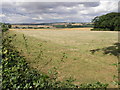
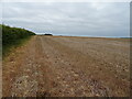
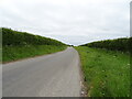
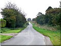
Photos of South Thoresby


Area Information
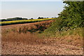
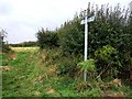
South Thoresby sits as a civil parish in England, covering a defined stretch of 12.0 km². This specific land area shapes the limited space available for development, resulting in a distinct lack of density compared to larger urban centres. You will find that daily life here revolves around a government-defined boundary where the total acreage restricts the growth of built-up zones. The layout is dictated by these rigid geographic constraints, meaning every square metre counts towards the community's footprint. Residents navigate a landscape where the total spatial limits prevent the expansion of large-scale housing estates. Instead, the area maintains a fixed character defined by its 12.0 km² boundary. People consider South Thoresby when they seek a settled location where physical expansion is impossible. The parish structure ensures that local governance aligns with these fixed borders. You walk through an environment where the total area remains constant regardless of external pressures. This stability offers predictability for those who prefer living in South Thoresby where boundaries do not shift. The designation as a civil parish provides a clear administrative framework for this specific 12.0 km² zone. Your daily commute or local walk exists within these precise geographical limits. The area's identity is inextricably linked to this specific measurable landmass. Living in South Thoresby means accepting a defined sphere of influence.
- Area Type
- Parish
- Area Size
- 12.0 km²
- Population
- Not available
- Population Density
- Not available
Demographics
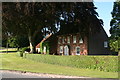
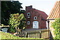
The population of South Thoresby reflects an older community structure with a median age of 70 years. You will encounter residents primarily drawn from the age category labelled as Total, indicating a broad but high-age demographic concentration. This older age profile suggests a neighbourhood where families with young children are not the dominant household type. Instead, you see a community adapted to the needs of senior citizens and those nearing retirement. Home ownership stands at a solid 72%, marking this area as an established market for those who have already purchased their property. This high level of ownership implies that most residents have financial stability and long-term roots in South Thoresby. The household composition data shows that the total demographic makeup aligns with an ageing population rather than a young workforce. Accommodation types generally mirror this ownership trend, favouring larger properties suited for established residents. Diversity metrics indicate that one ethnic group holds the predominant position within the total population count. Religious affiliation remains part of the total demographic record, reflecting established community traditions. You will not find the transient rental vibes typical of student towns. The demographic footprint is one of permanence, anchored by the 72% ownership rate and the median age of 70. Living in South Thoresby means joining a cohort of older residents.
Household Size
Accommodation Type
Tenure
Ethnic Group
Religion
Household Composition
Age
Household Deprivation
NS-SEC
Explore more demographic insights in this area
Go to Demographics tabPlanning
Planning Constraints
- Flood RiskLocked
- Ramsar Wetland SitesLocked
- Area of Outstanding Natural BeautyLocked
- Protected Nature ReserveLocked
- Protected WoodlandLocked
- Crime RiskLocked