Area Overview for South Cockerington
Photos of South Cockerington

Area Information
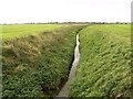
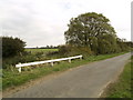
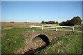
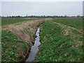
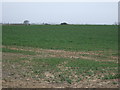
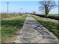
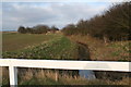
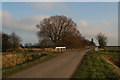
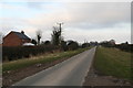
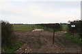
South Cockerington is a civil parish situated in the heart of England, covering a total area of 8.8 km². Living in this small community means navigating a landscape defined by its rural character and established residential history. The area functions as a distinct local unit where daily life revolves around a close-knit environment rather than urban sprawl. You will find that the settlement is compact enough for residents to know their neighbours, yet open enough to retain a sense of countryside quiet. This civil parish serves as a stable base for those seeking a traditional English lifestyle away from the noise and pace of larger towns. The physical boundaries of the parish define a specific home from the broader administrative divisions surrounding it. Prospective buyers looking for homes in South Cockerington are entering an area with a long-standing identity. The location offers a settled atmosphere where the ground rules of local living have been established over many years. This specific patch of land in England provides a clear sense of place for anyone moving to the region. The size of the parish ensures that you will not be losing yourself in the vastness of the wider county while still enjoying local autonomy. South Cockerington represents a straightforward example of rural living in the current property market.
- Area Type
- Parish
- Area Size
- 8.8 km²
- Population
- Not available
- Population Density
- Not available
Demographics
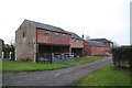
The community in South Cockerington reflects a mature population profile with a median age of 70 years. This figure indicates that most residents are older individuals who have settled permanently in the area. The dwelling stock supports this demographic shift, as 82% of households report full home ownership. This high rate of ownership suggests a community where families and seniors have established long-term roots rather than relying on the rental sector. The data presents a clear picture of a neighbourhood occupied by people with significant ties to the local address. Those seeking homes in South Cockerington will primarily encounter owner-occupiers who have likely stayed through various life stages. The household composition remains steady, driven by the preference for stability inherent in this age group. You will find that the local population values the security of owning their property in such a small parish. The age profile contrasts sharply with towns dominated by young commuters or students, creating a different dynamic for social interaction. Living in this area means engaging with a crowd that has time and financial commitment invested in real estate. This settled demographic reduces the turnover rate typically found in mixed-use developments across the county. The predominance of older residents shapes the pace of life throughout the parish.
Household Size
Accommodation Type
Tenure
Ethnic Group
Religion
Household Composition
Age
Household Deprivation
NS-SEC
Explore more demographic insights in this area
Go to Demographics tabPlanning
Planning Constraints
- Flood RiskPremium
- Ramsar Wetland SitesPremium
- Area of Outstanding Natural BeautyPremium
- Protected Nature ReservePremium
- Protected WoodlandPremium
- Crime RiskPremium