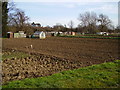
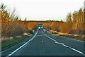
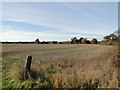
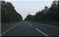
Area Overview for Sleaford Westholme Ward
Photos of Sleaford Westholme Ward
Area Information
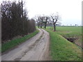
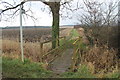
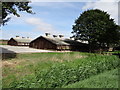
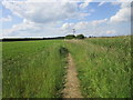
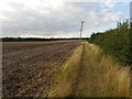
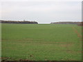
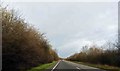
Sleaford Westholme Ward sits within the North Kesteven District Council area of Lincolnshire, forming part of the Sleaford and North Hykeham parliamentary constituency. You will find this ward located in a rural district southwest of Lincoln, centred roughly around the coordinates 53.0024°N, 0.4291°W. The ward covers a compact 2.0 km² area, making it a relatively small but defined locality for those considering living in Sleaford Westholme Ward. As an electoral ward within the East Midlands region, this location offers a specific slice of life close to the town of Sleaford. The boundaries have been established by the Boundary Commission for England, ensuring consistent representation for residents. If you are exploring homes in Sleaford Westholme Ward, you are entering a distinct zone that balances rural character with proximity to larger services. The area is defined by its position near Sleaford and its integration into the wider English local government structure. You do not find major industrial zones or dense urban sprawl here, but rather a structured neighbourhood approach to housing and planning. Your daily routine will likely involve navigating the boundaries set by North Kesteven District Council while enjoying the broader context of the East Midlands.
- Area Type
- District Borough Unitary Ward
- Area Size
- 2.0 km²
- Population
- Not available
- Population Density
- Not available
Demographics
The community profile for Sleaford Westholme Ward shows a significant skew towards older residents. You will encounter a median age of 70 years for the population living in Sleaford Westholme Ward. This statistical reality suggests a population with established routines and potentially lower demand for gym facilities or youth-specific entertainment. The most common age range data simply categorises the total age group, confirming the dominance of the elderly demographic within this specific ward. Home ownership stands at 60 per cent, meaning twelve out of every twenty people in Sleaford Westholme Ward own their property outright or with a mortgage. This high ownership rate often correlates with an area hit with younger families and long-term residents who have stayed for decades. Accommodation types, household composition, predominant ethnic groups, and religious affiliation data are recorded as totals for the standard categories, indicating the broad sweep of standard demographic variables apply here. Specifically regarding economic hardship, there is no separate deprivation data score provided in this dataset, so you cannot claim the ward is more or less deprived than the national average based on these figures alone. For families shopping for homes in Sleaford Westholme Ward, the statistics point to a mature market where neighbours are likely to be similar in age to you if you are an older buyer.
Household Size
Accommodation Type
Tenure
Ethnic Group
Religion
Household Composition
Age
Household Deprivation
NS-SEC
Explore more demographic insights in this area
Go to Demographics tabPlanning
Planning Constraints
- Flood RiskPremium
- Ramsar Wetland SitesPremium
- Area of Outstanding Natural BeautyPremium
- Protected Nature ReservePremium
- Protected WoodlandPremium
- Crime RiskPremium