Area Overview for Sleaford
Photos of Sleaford


Area Information
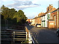
Sleaford, a built-up area in England covering 5.5 km², offers a compact yet well-connected environment for residents. With a median age of 70, the community reflects a demographic skew towards older adults, shaping a distinct local character. The area’s size ensures a close-knit feel, where daily life is centred around familiar landmarks and local services. Sleaford’s proximity to key amenities, including multiple schools and rail stations, supports both practical needs and leisure. While not a sprawling city, its manageable scale makes it accessible for those seeking a quieter lifestyle without sacrificing connectivity. The presence of RAF Cranwell nearby adds a layer of regional significance, while local shops and transport links provide convenience. For those considering living in Sleaford, the balance of practicality and community presence is evident, though the age profile suggests a need to consider long-term care and social infrastructure.
- Area Type
- Built Up Area 250
- Area Size
- 5.5 km²
- Population
- Not available
- Population Density
- Not available
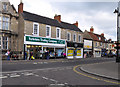
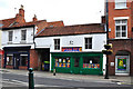
Sleaford’s lifestyle is shaped by its accessible amenities, including retail hubs like Sainsburys Sleaford, Iceland Sleaford, and Tesco Sleaford, which cater to daily shopping needs. The rail network, with stations at Sleaford, Rauceby, and Ruskington, provides convenient travel options for commuters and visitors. Nearby RAF Cranwell offers a unique local presence, though its impact on civilian life is not detailed. The area’s compact size ensures that essential services are within practical reach, supporting a self-contained lifestyle. While parks and leisure facilities are not specified in the data, the availability of multiple schools and retail options suggests a focus on community and practical living. For residents, the balance of local shops, transport, and regional links creates a functional, if modest, lifestyle.
Amenities
Schools
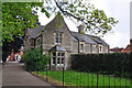
Sleaford is served by a selection of primary schools, including Church Lane Primary School & Nursery, which holds an outstanding Ofsted rating. Other institutions such as The St Botolph’s Church of England Infant School, Our Lady of Good Counsel Catholic Primary School, and William Alvey School provide additional options for families. Kesteven and Sleaford High School, though listed as a primary school, may offer transitional support for older children. The presence of multiple primary schools suggests a focus on early education, though secondary school options are not detailed in the data. Families prioritising strong early education may find Sleaford’s schools appealing, particularly Church Lane’s high rating. However, buyers should verify secondary school availability separately, as the data does not cover it.
| Rank | School | Type | Entry gender | Ages |
|---|
Explore more schools in this area
Go to Schools tabDemographics
Sleaford’s population has a median age of 70, indicating a community predominantly composed of older residents. This age profile influences the area’s dynamics, with household types and accommodation needs likely shaped by retirement living. Home ownership stands at 67%, suggesting a mix of owner-occupied properties and rental stock, though specific data on rental rates or household composition is not provided. The accommodation types are not detailed, but the high home ownership rate implies a stable, settled population. The area’s demographic makeup does not include specific figures on ethnic diversity or religious composition, but the absence of such data does not detract from the clear trend of an aging community. This profile may affect local services and amenities, with a focus on healthcare and community support. For prospective buyers, understanding the age demographic is key to assessing long-term suitability.