Area Overview for Skellingthorpe & Eagle Ward
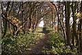
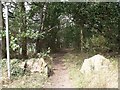
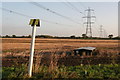
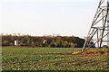
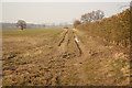
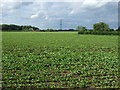
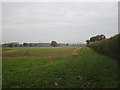
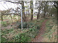
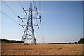
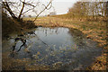
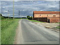
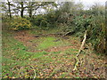
Photos of Skellingthorpe & Eagle Ward
Area Information
Skellingthorpe & Eagle Ward stands as an electoral ward in Lincolnshire, situated within the East Midlands region of England. This district covers a total area size of 52.8 km², offering a defined space for local life near the wider Lincolnshire landscape. You will find Skellingthorpe & Eagle Ward approximately 3 miles west of Lincoln and 4 miles southeast of Saxilby. The location also lies 6 miles northwest of North Hykeham and maintains a distance of 15 miles east of Tuxford. The ward contains 204 total postcodes, with 156 currently active for use. These geographic facts place the ward firmly in the rural-urban interface, bridging the gap between Lincoln and the surrounding villages. Daily life here revolves around proximity to established market towns while retaining local village identities. The specific layout of 204 postcodes suggests a dispersed settlement pattern rather than a single dense urban cluster. Buyers assessing this area recognise it as a specific electoral boundary that captures both built-up and semi-rural environments. Understanding these boundaries helps you visualise exactly what you are purchasing when you look at homes in Skellingthorpe & Eagle Ward.
- Area Type
- District Borough Unitary Ward
- Area Size
- 52.8 km²
- Population
- Not available
- Population Density
- Not available
Demographics
The community within Skellingthorpe & Eagle Ward presents a distinct demographic profile compared to many other parts of the UK. You will find that the median age for residents in this ward is 70 years. This high median age indicates a population skewed towards older adults and retirees rather than families with young children or young professionals. The most common age range recorded in the data is listed simply as Age: Total, confirming the average serves as the primary metric for understanding the resident base. Home ownership stands at 80%, a figure that significantly outpaces national averages for similar rural districts. This high level of ownership suggests stability within the neighbourhood and a tradition of long-term residency rather than short-term tenancy. Household composition and accommodation type data are recorded as total categories, reflecting the aggregated nature of the ward's residential stock. Ethnic diversity information is recorded as a total group, indicating a relatively homogenous population structure typical of established rural parishes. Religion data is also aggregated under a total category. The combination of a median age of 70 and an 80% home ownership rate creates a settled environment where residents have made Skellingthorpe & Eagle Ward their permanent home.
Household Size
Accommodation Type
Tenure
Ethnic Group
Religion
Household Composition
Age
Household Deprivation
NS-SEC
Explore more demographic insights in this area
Go to Demographics tabPlanning
Planning Constraints
- Flood RiskPremium
- Ramsar Wetland SitesPremium
- Area of Outstanding Natural BeautyPremium
- Protected Nature ReservePremium
- Protected WoodlandPremium
- Crime RiskPremium