Area Overview for Skegby Ward
Photos of Skegby Ward


Area Information
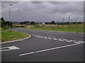
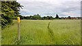
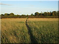
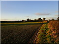
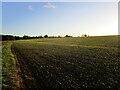
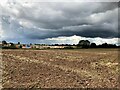
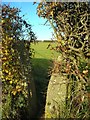
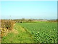
Skegby Ward occupies a specific and defined space within the Ashfield district of Nottinghamshire, covering an area of exactly 4.8 square kilometres. This district ward encompasses the village of Skegby, which sits strategically on the B6014 road, positioned two miles west of Mansfield and one mile north of Sutton-in-Ashfield. The settlement is built around a deep valley at the source of the River Meden, creating a distinct geographical character that has been continuous since the Domesday Book of 1086. Historically, the land belonged to Roger of Bully and was associated with the King's manor at Mansfield until the mid-14th century. The ward retains strong historical roots, once hosting a population of 6,519 in 1931, before merging with Sutton-in-Ashfield. Daily life here is shaped by a landscape of historic features and practical amenities. You will find yourself surrounded by landmarks such as the 18th-century Pinfold on Mansfield Road, the 17th-century Quaker House, and the 13th-century ruins of Skegby Manor House. The Skegby Heritage Trail, launched in October 2009, guides visitors and residents through nine significant historical sites. Modern convenience is provided by essential services, including a library shared with Stanton Hill, a family surgery, and local retail outlets. Living in Skegby Ward means accessing a mix of rural tranquility and village infrastructure, anchored by the former industrial heritage of coal mining and limestone quarrying that flourished in the 1800s. The area offers a tangible connection to the East Midlands' past while serving contemporary households with practical local facilities.
- Area Type
- District Borough Unitary Ward
- Area Size
- 4.8 km²
- Population
- Not available
- Population Density
- Not available
Demographics
The community within Skegby Ward reflects a settled demographic with a very mature age profile. The median age for residents is 70, indicating that the area is predominantly populated by older adults. This age skew suggests a slower pace of life compared to younger urban districts. Regarding household composition and accommodation types, the specific breakdowns are not detailed in the available records, but the ownership dynamics are clear. Home ownership stands at 71%, which is a substantial figure for the UK. This rate suggests that the majority of the population lives in properties they either bought or inherited rather than renting. The high level of home ownership typically correlates with stability and long-term settlement, aligning with the older resident base. When you consider where families or couples might look for homes in Skegby Ward, the data indicates a market where material assets are already widely held. This contrasts with areas driven by student housing or short-term rented flats. The ethnic and religious diversity data is recorded as total, meaning the ward operates with broad, unquantified diversity or homogeneous statistics that were not broken down further in the records. For anyone considering moving, the environment feels rooted in tradition, supported by local institutions like St. Andrew's Church of England parish church and Skegby Methodist Church. The social fabric appears stable, with the majority of adults over 50 fostering a neighbourhood atmosphere centred on familiarity and established community ties.
Household Size
Accommodation Type
Tenure
Ethnic Group
Religion
Household Composition
Age
Household Deprivation
NS-SEC
Explore more demographic insights in this area
Go to Demographics tabPlanning
Planning Constraints
- Flood RiskPremium
- Ramsar Wetland SitesPremium
- Area of Outstanding Natural BeautyPremium
- Protected Nature ReservePremium
- Protected WoodlandPremium
- Crime RiskPremium