Area Overview for Skeffington
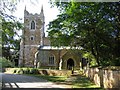
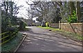
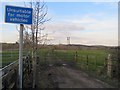
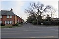
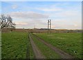
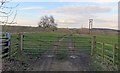
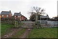
Photos of Skeffington


Area Information
Living in Skeffington offers a distinctly quiet existence within a civil parish covering 8.8 km². This rural settlement avoids the typical pressures of urban sprawl, providing residents with a low-density environment where the pace of life remains unhurried. The area stands apart due to its specific planning constraints and environmental profile, particularly the presence of protected woodland, which shapes the local landscape. You will find a community that values stability, evidenced by the lack of Ramsar wetland sites or Areas of Outstanding Natural Beauty that might otherwise restrict development. Instead, the focus remains on preserving existing green spaces while maintaining a manageable footprint. Daily life revolves around this preserved nature, offering a backdrop of trees and open sky without the financial or time constraints often associated with restricted planning zones. The absence of high-risk flood coverage provides a layer of security that many coastal or valley settlements lack. Your home here exists in a space defined by its history and its natural limitations, ensuring that the character of the parish remains intact. This is a place chosen for peace and specific environmental backing rather than for rapid growth or commercial vibrancy. The 8.8 km² expanse provides ample room while preventing the sprawl that typically plagues expanding villages. The community in Skeffington is defined by its older population and high level of stability. You will encounter a median age of 70, making this one of the most mature parishes in the region. Most residents fall into the oldest age bracket, reflecting a locality where people settle for the long term and value a tranquil retirement setting. Nearly 81% of the population owns their home outright, creating a neighbourhood built on equity rather than short-term tenancy. This high ownership rate translates to a community deeply invested in its immediate surroundings, as homeowners are typically more likely to maintain their properties and engage with local affairs. You will find few transient households, resulting in consistent neighbourly interactions that develop slowly over decades. The accommodation types reflect this demographic, likely consisting of traditional houses adapted for older living standards rather than modern high-density flats. While specific data on household composition breakdowns is not detailed, the overwhelming ownership suggests a static population committed to the area. Your experience of living here will be one of familiarity, where local shops and services cater to a steady, long-term customer base. The lack of recent migration or rapid influx of young professionals means the social scene centres around established networks rather than new social formations. The property market in Skeffington reflects a long-standing tradition of home ownership rather than a dynamic rental sector. With 81% of the population owning their home, the local housing stock is dominated by residents who have purchased property over many years. This implies that the majority of homes in the parish are freehold and likely held by families who have been there for generations. You will rarely encounter leasehold arrangements or short-term lets, creating a market driven by owner-occupiers rather than investors or landlords. The accommodation types prevailing in the area suggest a focus on traditional housing forms suitable for older residents, aligning with the median age of 70. When you look at homes in Skeffington, you are looking at properties that have served their original communities well. The market is quiet and deliberate, with transactions occurring less frequently than in neighbouring urban hubs. Buyers seeking a rental property may find limited inventory, whereas those looking to purchase will face a market that prioritises stability. The high ownership rate indicates that prices have historically appreciated steadily, reflecting the desire to own a piece of this protected woodland parish. You should expect a transaction process that is thorough and grounded in local knowledge, rather than the brisk, high-volume exchanges common elsewhere. Digital connectivity in Skeffington presents a mixed picture that you must weigh carefully before committing to living here. Mobile coverage scores an 83, indicating good signal strength across most of the parish and allowing for reliable use of smartphones and mobile networks during your daily travels. This is essential if you rely on your phone for navigation or emergencies while exploring the 8.8 km² expanse. However, fixed broadband quality tells a different story, with a score of only 17 out of 100. This level of performance is poor and likely to cause frustration for anyone requiring high-speed internet for working from home, streaming high-definition content, or managing multiple household devices simultaneously. You may experience frequent slowdowns or connection drops during peak usage times. If your livelihood depends on a stable video conference link or large file transfers, this deficiency could severely impact your daily routine. The disparity between mobile and fixed connectivity suggests that infrastructure investment has prioritised wireless reach over wired capacity. While you can stay connected on the move, being tethered to your home computer may feel isolating given the current limitations. Prospective buyers working remotely should conduct their own tests to confirm whether the provider networks currently serving the parish can meet your specific professional needs. Residential safety and environmental stability in Skeffington offer a reassuring profile for prospective buyers. Crime risk scores an 80 out of 100, placing the area well below the national average and indicating a safe neighbourhood where theft and violence are uncommon concerns. You can expect to walk about the parish at ease, knowing that criminal activity poses minimal threat to your household. Regarding flood risk, the score of 1.22 confirms low coverage of such hazards, protecting your property from water damage and subsidence risks associated with rising water levels. Planning constraints also provide a layer of environmental security. There are no Ramsar wetland sites or Areas of Outstanding Natural Beauty bordering the parish, removing strict development restrictions that often complicate renovations or extensions. However, you must acknowledge the presence of protected woodland, which carries a warning level in site assessments. This feature, while beautiful, imposes planning limitations that could restrict future construction projects on your land. The environmental score reflects a blend of safety and preservation, ensuring that the natural beauty remains intact. You benefit from a stable, low-crime environment, though you should be prepared for potential hurdles if you wish to alter the structure of your existing home due to the protected nature of the surrounding woods. What is the primary demographic of residents in Skeffington?The residents are predominantly older, with a median age of 70 and most people falling into the oldest age range. This creates a mellow community where stability is the norm. Is the area safe from crime and flooding?Yes. The crime risk score is 80, indicating well-below-average crime rates. Flood risk coverage is also low, with a score of 1.22, offering significant protection for your property. Will I get good broadband for working from home?Not necessarily. While mobile coverage is good with a score of 83, fixed broadband scores only 17 out of 100. You may struggle with high-speed internet requirements at home. Are there planning restrictions on building or renovating?The parish contains protected woodland, which carries a warning level in assessments. This means you face potential constraints on new developments or significant alterations to your property.
- Area Type
- Parish
- Area Size
- 8.8 km²
- Population
- Not available
- Population Density
- Not available
Demographics
The community in Skeffington is defined by its older population and high level of stability. You will encounter a median age of 70, making this one of the most mature parishes in the region. Most residents fall into the oldest age bracket, reflecting a locality where people settle for the long term and value a tranquil retirement setting. Nearly 81% of the population owns their home outright, creating a neighbourhood built on equity rather than short-term tenancy. This high ownership rate translates to a community deeply invested in its immediate surroundings, as homeowners are typically more likely to maintain their properties and engage with local affairs. You will find few transient households, resulting in consistent neighbourly interactions that develop slowly over decades. The accommodation types reflect this demographic, likely consisting of traditional houses adapted for older living standards rather than modern high-density flats. While specific data on household composition breakdowns is not detailed, the overwhelming ownership suggests a static population committed to the area. Your experience of living here will be one of familiarity, where local shops and services cater to a steady, long-term customer base. The lack of recent migration or rapid influx of young professionals means the social scene centres around established networks rather than new social formations. The property market in Skeffington reflects a long-standing tradition of home ownership rather than a dynamic rental sector. With 81% of the population owning their home, the local housing stock is dominated by residents who have purchased property over many years. This implies that the majority of homes in the parish are freehold and likely held by families who have been there for generations. You will rarely encounter leasehold arrangements or short-term lets, creating a market driven by owner-occupiers rather than investors or landlords. The accommodation types prevailing in the area suggest a focus on traditional housing forms suitable for older residents, aligning with the median age of 70. When you look at homes in Skeffington, you are looking at properties that have served their original communities well. The market is quiet and deliberate, with transactions occurring less frequently than in neighbouring urban hubs. Buyers seeking a rental property may find limited inventory, whereas those looking to purchase will face a market that prioritises stability. The high ownership rate indicates that prices have historically appreciated steadily, reflecting the desire to own a piece of this protected woodland parish. You should expect a transaction process that is thorough and grounded in local knowledge, rather than the brisk, high-volume exchanges common elsewhere. Digital connectivity in Skeffington presents a mixed picture that you must weigh carefully before committing to living here. Mobile coverage scores an 83, indicating good signal strength across most of the parish and allowing for reliable use of smartphones and mobile networks during your daily travels. This is essential if you rely on your phone for navigation or emergencies while exploring the 8.8 km² expanse. However, fixed broadband quality tells a different story, with a score of only 17 out of 100. This level of performance is poor and likely to cause frustration for anyone requiring high-speed internet for working from home, streaming high-definition content, or managing multiple household devices simultaneously. You may experience frequent slowdowns or connection drops during peak usage times. If your livelihood depends on a stable video conference link or large file transfers, this deficiency could severely impact your daily routine. The disparity between mobile and fixed connectivity suggests that infrastructure investment has prioritised wireless reach over wired capacity. While you can stay connected on the move, being tethered to your home computer may feel isolating given the current limitations. Prospective buyers working remotely should conduct their own tests to confirm whether the provider networks currently serving the parish can meet your specific professional needs. Residential safety and environmental stability in Skeffington offer a reassuring profile for prospective buyers. Crime risk scores an 80 out of 100, placing the area well below the national average and indicating a safe neighbourhood where theft and violence are uncommon concerns. You can expect to walk about the parish at ease, knowing that criminal activity poses minimal threat to your household. Regarding flood risk, the score of 1.22 confirms low coverage of such hazards, protecting your property from water damage and subsidence risks associated with rising water levels. Planning constraints also provide a layer of environmental security. There are no Ramsar wetland sites or Areas of Outstanding Natural Beauty bordering the parish, removing strict development restrictions that often complicate renovations or extensions. However, you must acknowledge the presence of protected woodland, which carries a warning level in site assessments. This feature, while beautiful, imposes planning limitations that could restrict future construction projects on your land. The environmental score reflects a blend of safety and preservation, ensuring that the natural beauty remains intact. You benefit from a stable, low-crime environment, though you should be prepared for potential hurdles if you wish to alter the structure of your existing home due to the protected nature of the surrounding woods. What is the primary demographic of residents in Skeffington?The residents are predominantly older, with a median age of 70 and most people falling into the oldest age range. This creates a mellow community where stability is the norm. Is the area safe from crime and flooding?Yes. The crime risk score is 80, indicating well-below-average crime rates. Flood risk coverage is also low, with a score of 1.22, offering significant protection for your property. Will I get good broadband for working from home?Not necessarily. While mobile coverage is good with a score of 83, fixed broadband scores only 17 out of 100. You may struggle with high-speed internet requirements at home. Are there planning restrictions on building or renovating?The parish contains protected woodland, which carries a warning level in assessments. This means you face potential constraints on new developments or significant alterations to your property.
Household Size
Accommodation Type
Tenure
Ethnic Group
Religion
Household Composition
Age
Household Deprivation
NS-SEC
Explore more demographic insights in this area
Go to Demographics tabPlanning
Planning Constraints
- Flood RiskPremium
- Ramsar Wetland SitesPremium
- Area of Outstanding Natural BeautyPremium
- Protected Nature ReservePremium
- Protected WoodlandPremium
- Crime RiskPremium