Area Overview for SK23 7NP
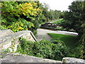
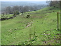
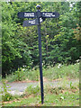
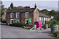
Photos of SK23 7NP


Area Information
SK23 7NP is a specific postcode area covering a small residential cluster in England. The territory spans 19.3 hectares and accommodates a population of 1,331 residents. This translates to a population density of 296 people per square kilometre. You will find a quiet, private environment where the built-up space meets the natural surroundings. The nature of this postcode indicates a tight-knit community rather than a sprawling urban sprawl. Daily life here revolves around a residential focus with limited commercial infrastructure within the immediate bounds of the cluster. Residents benefit from a rural setting while maintaining access to wider regional services. The area is distinct for its modest scale, which means you are not dealing with the noise and congestion of larger towns. Instead, you gain a sense of seclusion. The small size of the cluster often fosters neighbourly recognition and local interaction. When you purchase a home in SK23 7NP, you are entering an environment defined by its compact footprint and settled character. This makes it particularly suitable for those who prefer a low-traffic existence without being isolated from essential amenities elsewhere in the district.
- Area Type
- Postcode
- Area Size
- 19.3 hectares
- Population
- 1331
- Population Density
- 296 people/km²
The property market in SK23 7NP is characterised by a stock dominated by houses. With 74 per cent of households being owner-occupied, the area functions as a settled residential zone rather than a student ghetto or a high-turnover rental market. This high level of ownership means that when you view properties for sale, you are looking at homes chosen by residents to stay in for the long term. The accommodation type is strictly houses, so you will not find flats or bungalows unless they are self-contained units within a larger estate. This homogeneity simplifies your search if you specifically want a detached or semi-detached property typical of rural or semi-rural English settlements. Because the area is a small residential cluster covering 19.3 hectares, inventory levels may be lower than in larger towns. This scarcity often drives competition for available stock. The fact that the majority of residents own their homes implies that the cost base reflects longevity of tenure rather than short-term lease demands. For buyers entering the local market, the houses here represent a commitment to a traditional form of dwelling. This setup usually attracts purchasers looking for gardens and space rather than urban convenience.
House Prices in SK23 7NP
Showing 5 properties
| Address | Type | Beds | Baths | Last Sale Price | Last Sale Date | |
|---|---|---|---|---|---|---|
| Springfield House, Unnamed Road From Stubbins Lane To Tithe Barn Farm, Chinley, SK23 7NP | house | - | - | - | - | |
| Cherry Tree Cottage, Cote Bank Farm, Unnamed Road From Stubbins Lane To Tithe Barn Farm, Chinley, SK23 7NP | Semi-detached | 3 | 1 | - | - | |
| Cote Bank Farm, Unnamed Road From Stubbins Lane To Tithe Barn Farm, Chinley, SK23 7NP | Semi-detached | - | - | - | - | |
| The Old House, Cote Bank Farm, Unnamed Road From Stubbins Lane To Tithe Barn Farm, Chinley, SK23 7NP | house | - | - | - | - | |
| Chinley House Farm, Dolly Lane, Buxworth, SK23 7NP | Detached | - | - | - | - |
Energy Efficiency in SK23 7NP
Lifestyle in SK23 7NP is driven by proximity to key amenities within a practical reach of the residential cluster. You have five notable rail options nearby, including Chinley Railway Station, Whaley Bridge Railway Station, and Furness Vale Railway Station. These transport hubs provide a lifeline connecting you to broader regional centres for commuting or leisure. For daily shopping, five retail venues serve the area. Notable stores include Tesco High, Co-op Buxton, and Aldi Chapel en le. Having access to major supermarkets like Tesco and Aldi means you can cater your weekly grocery shop without travelling deep into neighbouring towns. The Co-op location offers additional convenience for smaller items. While dining and leisure options within specific named eateries are not detailed in this data, the retail connectivity ensures basic necessities are always within reach. You do not need to drive for miles for essentials. The combination of rail access and strong retail partners creates a balanced convenience model. Residents can enjoy a quiet home life while retaining the ability to step out for larger purchases or travel easily.
Amenities
Schools
Families in SK23 7NP have access to specific educational institutions within practical reach. The nearest school is Buxworth Primary School, which sits as a primary institution in the local vicinity. Ofsted rates Buxworth Primary School as good, indicating a satisfactory standard of education according to government inspectors. There are no secondary schools listed in the immediate data for this specific postcode area, meaning older children in your household may need to travel further for high school education. The presence of a primary school with a good rating ensures that younger children can access locally situated education. This mix supports families with children in the early years while those with teenagers must plan for a commute. You rely heavily on this single listed institution for primary education needs. The good rating suggests a stable curriculum and environment for your young students. While the data does not detail additional academies or campuses, Buxworth Primary School serves as the designated local point of reference. When assessing your options for schools near SK23 7NP, this clear rating provides a concrete benchmark for quality.
| Rank | School | Type | Entry gender | Ages |
|---|
Explore more schools in this area
Go to Schools tabDemographics
The community in SK23 7NP is defined by a mature age profile with a median age of 47 years. The most common age range for residents is adults between 30 and 64 years. This demographic skew suggests the area attracts established households rather than young singles or empty nesters. Home ownership stands at 74 per cent of all households. This high figure indicates that the area is not a transient rental zone but a place for long-term settlement. Accommodation types are exclusively houses, meaning you will not find flats or purpose-built apartments within this specific cluster. The predominant ethnic group is White, reflecting the broader regional makeup of the surrounding countryside. These facts combine to create a demographic where stability is the norm. The high home ownership rate typically correlates with lower turnover and a more rooted community fabric. When you look at who lives here, you see families and retirees who have chosen to stay. The absence of rental properties reinforces this stability. You can expect neighbours who are likely to know each other for decades. This demographic consistency offers a predictable environment for prospective buyers seeking permanence over rapid change.
Household Size
Accommodation Type
Tenure
Ethnic Group
Religion
Household Composition
Age
Household Deprivation
NS-SEC
Explore more demographic insights in this area
Go to Demographics tabPlanning
Planning Constraints
- Flood RiskPremium
- Ramsar Wetland SitesPremium
- Area of Outstanding Natural BeautyPremium
- Protected Nature ReservePremium
- Protected WoodlandPremium