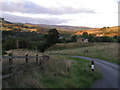
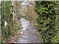
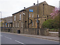
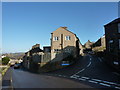
Area Overview for SK23 7AA
Photos of SK23 7AA


Area Information
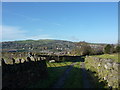
Living in SK23 7AA means residing within a tightly knit residential cluster covering just over nine thousand square metres. This specific postcode houses 1,755 residents, creating a community with a population density of 1,204 people per square kilometre. You will find yourself in a setting defined by its compact nature and clear residential focus. The area stands as a distinct micro-community within the wider district, offering a sense of locality without the sprawl of larger towns. Daily life here revolves around immediate neighbours and local access points. The size of the land area ensures a contained environment where everyone is within a short reach of others. Prospective buyers should see SK23 7AA as an established residential node rather than a developing frontier. The population figure indicates a stable presence rather than a fluctuating tourist engagement. You are looking at a place where the residential character dominates the landscape. The 9,102 square metre footprint confines the development to a manageable scale. This limits the variety of land uses to housing and essential support services. You will not encounter mixed-use industrial zones or large commercial developments within this specific boundary. The environment is strictly domestic. The compact size means you rely heavily on proximity to services outside this immediate block. Yet the density ensures a cohesive social structure. You can expect a neighbourhood where local knowledge matters more than anonymity. The 1,755 people living here form a shared community with immediate consequences for land use and service provision. SK23 7AA represents a specific slice of the local housing market defined by these hard boundaries.
- Area Type
- Postcode
- Area Size
- 9102 m²
- Population
- 1755
- Population Density
- 1204 people/km²
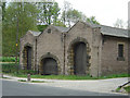
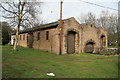
The property market in SK23 7AA is defined by a strong preference for private ownership. With 73 per cent of homes owner-occupied, this postcode acts as a snapshot of the local buyer rather than the local landlord. You will encounter a market where security of tenure is the norm over short-term tenancy agreements. This statistic points to a constituency of residents who have already navigated the purchase process and are staying put. Houses dominate the stock entirely within this 9,102 square metre area. You will not find flats, conversions, or purpose-built rental schemes in SK23 7AA. Every available property falls under the category of a house. This limits your options to detached, semi-detached, or terraced layouts suited to family living or retirement needs. The absence of flat options means buyers seeking convenient, low-maintenance urban living will need to look to adjacent postcodes. For those seeking a garden and traditional living, this area delivers exactly what is required. The high ownership percentage implies limited rental yield opportunities for investors targeting this specific cluster. Instead, the market rewards long-term capital appreciation and family stability. You are dealing with a stock that prioritises space and permanence. The 1,755 population supports a housing stock built for occupancy rather than turnover. This creates a robust but narrow market where the primary product is the brick-and-mortar house. Buyers exploring SK23 7AA should prepare for a purchase-driven environment with little business-as-usual activity in the local rental sector.
House Prices in SK23 7AA
Showing 24 properties
| Address | Type | Beds | Baths | Last Sale Price | Last Sale Date | |
|---|---|---|---|---|---|---|
| 9A Market Street, Whaley Bridge, SK23 7AA | Flat | 2 | 1 | - | - | |
| 9B Market Street, Whaley Bridge, SK23 7AA | Flat | 4 | 2 | - | - | |
| 3A Market Street, Whaley Bridge, SK23 7AA | Flat | 1 | 1 | - | - | |
| Riverslie, 1 Market Street, Whaley Bridge, SK23 7AA | Flat | - | - | - | - | |
| 25A Market Street, Whaley Bridge, SK23 7AA | Detached | - | - | - | - | |
| The Railway Hotel, 33-35 Market Street, Whaley Bridge, SK23 7AA | restaurant_cafe | - | - | - | - | |
| Flat 3 Riverslie, 1 Market Street, Whaley Bridge, SK23 7AA | Flat | - | - | - | - | |
| 5A Market Street, Whaley Bridge, SK23 7AA | Flat | - | - | - | - | |
| Flat 2 Riverslie, 1 Market Street, Whaley Bridge, SK23 7AA | Flat | - | - | - | - | |
| 23 Market Street, Whaley Bridge, SK23 7AA | Terraced | - | - | - | - |
Energy Efficiency in SK23 7AA
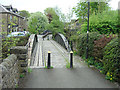
Daily life in SK23 7AA centres on access to reliable services without requiring long journeys. Residents benefit from five retail outlets located nearby, ensuring essential shopping remains within reach. Co-op Buxton, Tesco High, and Spar High stand out as the primary names for your weekly grocery runs. You can stock up on essentials without leaving the district or undertaking a significant commute. These venues support the practical needs of the 1,755 people living here. Transport connectivity is anchored by five railway stations that serve as the gateway to broader destinations. Whaley Bridge Railway Station, Furness Vale Railway Station, and Chinley Railway Station offer routes for those needing to travel beyond the immediate locale. These stations are sufficiently close to allow for comfortable access by car or public transport. The presence of these rail links adds a layer of velocity to an otherwise compact residential area. The lifestyle here is defined by convenience and proximity. You live in a space where major shopping and train travel are predictable and organized. The 9,102 square metre area forces a reliance on these designated hubs rather than scattered local shops. Cooking at home becomes the norm with full supermarkets nearby. Travel to work or leisure involves planned trips to the identified stations. This structure ensures that daily errands do not consume disproportionate amounts of your time.
Amenities
Schools
| Rank | School | Type | Entry gender | Ages |
|---|
Explore more schools in this area
Go to Schools tabDemographics
The community in SK23 7AA reflects a mature household profile with a median age of 47 years. Most residents fall into the adult bracket between 30 and 64 years old, indicating a population settled in the prime working and mid-life stages. This age distribution suggests a neighbourhood focused on stability rather than transient student accommodation or rapid family expansion. You will find a demographic that values established lifestyles and long-term local ties. Home ownership stands at 73 per cent, placing SK23 7AA firmly within the owner-occupied sector. This high figure signals that most residents have purchased their homes and are likely invested in the local infrastructure. The remaining residential properties may see higher turnover rates, but the majority of the 1,755 population represents settled owners. This ownership level往往 correlates with a desire for quiet neighbourhoods and consistent property maintenance. Accommodation types are exclusively houses, meaning you will not find flats or high-rise living arrangements within this postcode. The preponderance of houses suggests a suburban or semi-rural layout rather than urban density. You will be purchasing ground-level or first-floor living spaces with private gardens. The dominant ethnic group is White, reflecting the broader regional demographic makeup of the East Midlands. This homogeneity helps maintain a consistent cultural atmosphere. Residents in SK23 7AA share a common background and likely similar expectations regarding noise levels and neighbourly conduct. The exclusion of flats reinforces the house-buyer focus of this 9,102 square metre zone.
Household Size
Accommodation Type
Tenure
Ethnic Group
Religion
Household Composition
Age
Household Deprivation
NS-SEC
Explore more demographic insights in this area
Go to Demographics tabPlanning
Planning Constraints
- Flood RiskPremium
- Ramsar Wetland SitesPremium
- Area of Outstanding Natural BeautyPremium
- Protected Nature ReservePremium
- Protected WoodlandPremium