Area Overview for SK22 4NP
Photos of SK22 4NP

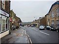
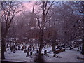
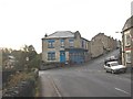
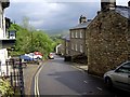
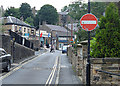
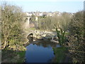
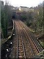
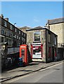
97 photos from this area
Area Information
Key information about the SK22 4NP including its size, population, and administrative classification.
- Area Type
- Postcode
- Area Size
- 3.4 hectares
- Population
- 1469
- Population Density
- 1333 people/km²
House Prices in SK22 4NP
12
Properties
£224,875
Average Sold Price
£63,000
Lowest Price
£305,000
Highest Price
Showing 12 properties
| Address | Type | Beds | Baths | Last Sale Price | Last Sale Date | |
|---|---|---|---|---|---|---|
| Briardene, Church Lane, New Mills, SK22 4NP | Semi-detached | 3 | 1 | £225,000 | Feb 2021 | |
| Penlee, Church Lane, New Mills, SK22 4NP | Detached | 3 | 1 | £285,000 | Nov 2017 | |
| Harmar, Church Lane, New Mills, SK22 4NP | Semi-detached | 3 | 1 | £187,000 | May 2016 | |
| Green Hills, Church Lane, New Mills, SK22 4NP | house | 3 | - | £235,000 | Jan 2016 | |
| Beech Cottage, Church Lane, New Mills, SK22 4NP | Detached | 4 | 2 | £300,000 | Aug 2014 | |
| Beech House, Church Lane, New Mills, SK22 4NP | Detached | 4 | 3 | £305,000 | Jul 2006 | |
| Thornwood House, Church Lane, New Mills, SK22 4NP | Detached | - | - | £199,000 | Jan 2003 | |
| Ivy Ridge, Church Lane, New Mills, SK22 4NP | Detached | - | - | £63,000 | Sep 1999 | |
| The Vicarage, Church Lane, New Mills, SK22 4NP | Detached | 3 | - | - | - | |
| St Georges Parish Hall, Church Lane, New Mills, SK22 4NP | commercial | - | - | - | - |
Page 1 of 2
Energy Efficiency in SK22 4NP
Amenities
Schools
| Rank | School | Type | Entry gender | Ages |
|---|
Explore more schools in this area
Go to Schools tabDemographics
Household Size
Two person
most common
Accommodation Type
Houses
most common
Tenure
71
majority
Ethnic Group
White
most common
Religion
N/A
most common
Household Composition
N/A
most common
Age
47
median
Adults (30-64 years)
most common
Household Deprivation
N/A
with no deprivation
NS-SEC
38
in Lower managerial occupations
Explore more demographic insights in this area
Go to Demographics tabPlanning
Planning Constraints
- Flood RiskPremium
- Ramsar Wetland SitesPremium
- Area of Outstanding Natural BeautyPremium
- Protected Nature ReservePremium
- Protected WoodlandPremium