Area Overview for SK22 4HU
Photos of SK22 4HU
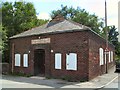
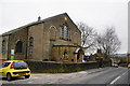
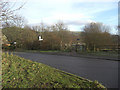
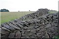
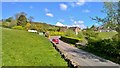
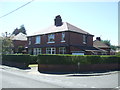
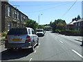
42 photos from this area
Area Information
Key information about the SK22 4HU including its size, population, and administrative classification.
- Area Type
- Postcode
- Area Size
- 1.9 hectares
- Population
- 1413
- Population Density
- 217 people/km²
House Prices in SK22 4HU
55
Properties
£139,933
Average Sold Price
£42,950
Lowest Price
£250,000
Highest Price
Showing 55 properties
| Address | Type | Beds | Baths | Last Sale Price | Last Sale Date | |
|---|---|---|---|---|---|---|
| 16 Beech Avenue, New Mills, SK22 4HU | Semi-detached | 3 | 1 | £250,000 | Aug 2024 | |
| 22 Beech Avenue, New Mills, SK22 4HU | house | - | - | £215,000 | Apr 2024 | |
| 43 Beech Avenue, New Mills, SK22 4HU | Terraced | 2 | 1 | £210,000 | Mar 2024 | |
| 35 Beech Avenue, New Mills, SK22 4HU | Semi-detached | 2 | 1 | £194,000 | Jan 2024 | |
| 1 Beech Avenue, New Mills, SK22 4HU | Terraced | 3 | 1 | £210,000 | Jun 2022 | |
| 29 Beech Avenue, New Mills, SK22 4HU | house | - | - | £185,000 | Jan 2022 | |
| 53 Beech Avenue, New Mills, SK22 4HU | house | - | - | £167,750 | Sep 2021 | |
| 4 Beech Avenue, New Mills, SK22 4HU | house | - | - | £142,000 | Sep 2018 | |
| 32 Beech Avenue, New Mills, SK22 4HU | Semi-detached | 2 | 1 | £115,000 | Jun 2017 | |
| 20 Beech Avenue, New Mills, SK22 4HU | house | - | - | £144,000 | Jul 2015 |
Page 1 of 6
Energy Efficiency in SK22 4HU
Amenities
Schools
| Rank | School | Type | Entry gender | Ages |
|---|
Explore more schools in this area
Go to Schools tabDemographics
Household Size
Two person
most common
Accommodation Type
Houses
most common
Tenure
77
majority
Ethnic Group
White
most common
Religion
N/A
most common
Household Composition
N/A
most common
Age
47
median
Adults (30-64 years)
most common
Household Deprivation
N/A
with no deprivation
NS-SEC
31
in Lower managerial occupations
Explore more demographic insights in this area
Go to Demographics tabPlanning
Planning Constraints
- Flood RiskPremium
- Ramsar Wetland SitesPremium
- Area of Outstanding Natural BeautyPremium
- Protected Nature ReservePremium
- Protected WoodlandPremium