Area Overview for SK22 2NR
Photos of SK22 2NR

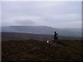
14 photos from this area
Area Information
Key information about the SK22 2NR including its size, population, and administrative classification.
- Area Type
- Postcode
- Area Size
- 2.8 km²
- Population
- 1864
- Population Density
- 113 people/km²
House Prices in SK22 2NR
13
Properties
£444,375
Average Sold Price
£272,500
Lowest Price
£634,000
Highest Price
Showing 13 properties
| Address | Type | Beds | Baths | Last Sale Price | Last Sale Date | |
|---|---|---|---|---|---|---|
| The Nook, Glossop Road, Little Hayfield, SK22 2NR | house | - | - | £300,000 | Jun 2021 | |
| Tom Heys Farm, Glossop Road, Little Hayfield, SK22 2NR | Detached | 5 | - | £634,000 | Aug 2019 | |
| Carr Meadow Farm, Glossop Road, Little Hayfield, SK22 2NR | house | 3 | - | £571,000 | Sep 2016 | |
| 2-3, Carr Meadow Cottages, Glossop Road, Little Hayfield, SK22 2NR | Cottage | 5 | 2 | £272,500 | Aug 2013 | |
| MARL HOUSE FARM, GLOSSOP ROAD, Little Hayfield, SK22 2NR | Semi-detached | - | - | - | - | |
| Heybarn Farm Cottage, Glossop Road, Little Hayfield, SK22 2NR | house | - | - | - | - | |
| The Rhododendrons, Glossop Road, Little Hayfield, SK22 2NR | Detached | - | - | - | - | |
| The Flat, Heybarn Farm, Glossop Road, Little Hayfield, SK22 2NR | Flat | - | - | - | - | |
| Heybarn Farm, Glossop Road, Little Hayfield, SK22 2NR | Terraced | - | - | - | - | |
| Carr Meadow View, Glossop Road, Little Hayfield, SK22 2NR | house | - | - | - | - |
Page 1 of 2
Energy Efficiency in SK22 2NR
Amenities
Schools
| Rank | School | Type | Entry gender | Ages |
|---|
Explore more schools in this area
Go to Schools tabDemographics
Household Size
Two person
most common
Accommodation Type
Houses
most common
Tenure
85
majority
Ethnic Group
White
most common
Religion
N/A
most common
Household Composition
N/A
most common
Age
47
median
Adults (30-64 years)
most common
Household Deprivation
N/A
with no deprivation
NS-SEC
44
in Lower managerial occupations
Explore more demographic insights in this area
Go to Demographics tabPlanning
Planning Constraints
- Flood RiskPremium
- Ramsar Wetland SitesPremium
- Area of Outstanding Natural BeautyPremium
- Protected Nature ReservePremium
- Protected WoodlandPremium