Area Overview for SK13 8TE
Photos of SK13 8TE
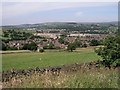
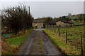
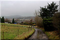
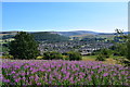
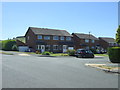
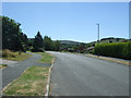
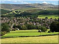
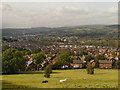
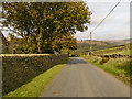
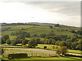
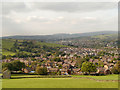
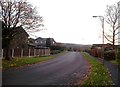
23 photos from this area
Area Information
Key information about the SK13 8TE including its size, population, and administrative classification.
- Area Type
- Postcode
- Area Size
- 8562 m²
- Population
- 2303
- Population Density
- 4809 people/km²
House Prices in SK13 8TE
14
Properties
£286,533
Average Sold Price
£108,000
Lowest Price
£550,000
Highest Price
Showing 14 properties
| Address | Type | Beds | Baths | Last Sale Price | Last Sale Date | |
|---|---|---|---|---|---|---|
| 9 Cross Rise, Glossop, SK13 8TE | Detached | 4 | 2 | £499,950 | Jul 2023 | |
| 5 Cross Rise, Glossop, SK13 8TE | house | - | - | £550,000 | Nov 2022 | |
| 13 Cross Rise, Glossop, SK13 8TE | house | - | - | £369,950 | Nov 2019 | |
| 4 Cross Rise, Glossop, SK13 8TE | house | - | - | £375,000 | Aug 2019 | |
| 12 Cross Rise, Glossop, SK13 8TE | Detached | 3 | 1 | £240,000 | Jan 2017 | |
| 1 Cross Rise, Glossop, SK13 8TE | house | - | - | £325,000 | Sep 2014 | |
| 11 Cross Rise, Glossop, SK13 8TE | house | - | - | £315,000 | May 2008 | |
| 3 Cross Rise, Glossop, SK13 8TE | house | - | - | £285,000 | Sep 2004 | |
| 8 Cross Rise, Glossop, SK13 8TE | Detached | - | - | £148,000 | Mar 2002 | |
| 10 Cross Rise, Glossop, SK13 8TE | Detached | - | - | £108,000 | Sep 2000 |
Page 1 of 2
Energy Efficiency in SK13 8TE
Amenities
Schools
| Rank | School | Type | Entry gender | Ages |
|---|
Explore more schools in this area
Go to Schools tabDemographics
Household Size
Family (3-5 people)
most common
Accommodation Type
Houses
most common
Tenure
85
majority
Ethnic Group
White
most common
Religion
N/A
most common
Household Composition
N/A
most common
Age
47
median
Adults (30-64 years)
most common
Household Deprivation
N/A
with no deprivation
NS-SEC
45
in Lower managerial occupations
Explore more demographic insights in this area
Go to Demographics tabPlanning
Planning Constraints
- Flood RiskPremium
- Ramsar Wetland SitesPremium
- Area of Outstanding Natural BeautyPremium
- Protected Nature ReservePremium
- Protected WoodlandPremium