Area Overview for SK13 8QJ
Photos of SK13 8QJ
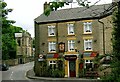
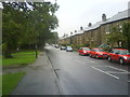
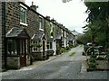
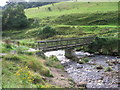
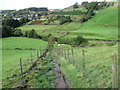
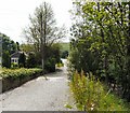
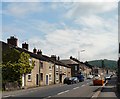
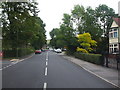
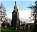
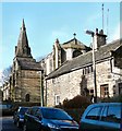
100 photos from this area
Area Information
Key information about the SK13 8QJ including its size, population, and administrative classification.
- Area Type
- Postcode
- Area Size
- 1.1 hectares
- Population
- 2303
- Population Density
- 4809 people/km²
House Prices in SK13 8QJ
38
Properties
£149,847
Average Sold Price
£38,000
Lowest Price
£490,000
Highest Price
Showing 38 properties
| Address | Type | Beds | Baths | Last Sale Price | Last Sale Date | |
|---|---|---|---|---|---|---|
| 1 Sheffield Road, Glossop, SK13 8QJ | Terraced | 2 | 1 | £170,000 | Oct 2025 | |
| 5 Sheffield Road, Glossop, SK13 8QJ | house | 2 | 1 | £196,500 | Dec 2024 | |
| 45 Sheffield Road, Glossop, SK13 8QJ | Terraced | 3 | 2 | £340,000 | Dec 2023 | |
| 23 Sheffield Road, Glossop, SK13 8QJ | house | - | - | £100,000 | Oct 2022 | |
| 57 Sheffield Road, Glossop, SK13 8QJ | Retail | 2 | 1 | £180,000 | Feb 2022 | |
| 37 Sheffield Road, Glossop, SK13 8QJ | Terraced | 2 | 1 | £128,000 | Mar 2021 | |
| 21 Sheffield Road, Glossop, SK13 8QJ | Terraced | 3 | 1 | £120,500 | Mar 2020 | |
| 25 Sheffield Road, Glossop, SK13 8QJ | house | - | - | £129,000 | Sep 2019 | |
| 71 Sheffield Road, Glossop, SK13 8QJ | house | - | - | £226,250 | Aug 2019 | |
| 81 Sheffield Road, Glossop, SK13 8QJ | house | - | - | £249,950 | Aug 2018 |
Page 1 of 4
Energy Efficiency in SK13 8QJ
Amenities
Schools
| Rank | School | Type | Entry gender | Ages |
|---|
Explore more schools in this area
Go to Schools tabDemographics
Household Size
Family (3-5 people)
most common
Accommodation Type
Houses
most common
Tenure
85
majority
Ethnic Group
White
most common
Religion
N/A
most common
Household Composition
N/A
most common
Age
47
median
Adults (30-64 years)
most common
Household Deprivation
N/A
with no deprivation
NS-SEC
45
in Lower managerial occupations
Explore more demographic insights in this area
Go to Demographics tabPlanning
Planning Constraints
- Flood RiskPremium
- Ramsar Wetland SitesPremium
- Area of Outstanding Natural BeautyPremium
- Protected Nature ReservePremium
- Protected WoodlandPremium