Area Overview for SK13 8HY
Photos of SK13 8HY
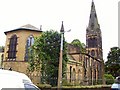
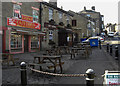
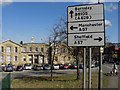
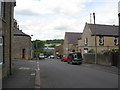
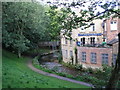
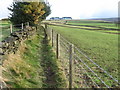
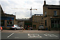
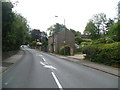

75 photos from this area
Area Information
Key information about the SK13 8HY including its size, population, and administrative classification.
- Area Type
- Postcode
- Area Size
- 7400 m²
- Population
- 1151
- Population Density
- 6747 people/km²
House Prices in SK13 8HY
23
Properties
£103,531
Average Sold Price
£25,000
Lowest Price
£200,000
Highest Price
Showing 23 properties
| Address | Type | Beds | Baths | Last Sale Price | Last Sale Date | |
|---|---|---|---|---|---|---|
| 46 Victoria Street, Glossop, SK13 8HY | house | - | - | £200,000 | Jun 2022 | |
| 41 Victoria Street, Glossop, SK13 8HY | house | - | - | £134,000 | Dec 2020 | |
| 45 Victoria Street, Glossop, SK13 8HY | Terraced | 2 | 1 | £125,000 | Sep 2020 | |
| 66 Victoria Street, Glossop, SK13 8HY | Semi-detached | 3 | 1 | £149,000 | Mar 2018 | |
| 74A Victoria Street, Glossop, SK13 8HY | Maisonette | 4 | - | £81,000 | Dec 2017 | |
| 74 Victoria Street, Glossop, SK13 8HY | Flat | - | - | £81,000 | Dec 2017 | |
| 64 Victoria Street, Glossop, SK13 8HY | house | - | - | £118,000 | May 2017 | |
| 58 Victoria Street, Glossop, SK13 8HY | Terraced | 3 | 1 | £102,000 | Jul 2016 | |
| 40 Victoria Street, Glossop, SK13 8HY | Terraced | 4 | 1 | £145,000 | Jun 2015 | |
| 44 Victoria Street, Glossop, SK13 8HY | Terraced | 2 | 1 | £105,000 | Jul 2007 |
Page 1 of 3
Energy Efficiency in SK13 8HY
Amenities
Schools
| Rank | School | Type | Entry gender | Ages |
|---|
Explore more schools in this area
Go to Schools tabDemographics
Household Size
Two person
most common
Accommodation Type
Houses
most common
Tenure
72
majority
Ethnic Group
White
most common
Religion
N/A
most common
Household Composition
N/A
most common
Age
47
median
Adults (30-64 years)
most common
Household Deprivation
N/A
with no deprivation
NS-SEC
38
in Lower managerial occupations
Explore more demographic insights in this area
Go to Demographics tabPlanning
Planning Constraints
- Flood RiskPremium
- Ramsar Wetland SitesPremium
- Area of Outstanding Natural BeautyPremium
- Protected Nature ReservePremium
- Protected WoodlandPremium