Area Overview for SK13 8HD
Photos of SK13 8HD

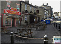
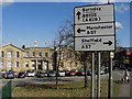
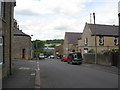
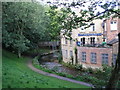

75 photos from this area
Area Information
Key information about the SK13 8HD including its size, population, and administrative classification.
- Area Type
- Postcode
- Area Size
- 4495 m²
- Population
- 2104
- Population Density
- 1551 people/km²
House Prices in SK13 8HD
17
Properties
£148,400
Average Sold Price
£3,000
Lowest Price
£265,000
Highest Price
Showing 17 properties
| Address | Type | Beds | Baths | Last Sale Price | Last Sale Date | |
|---|---|---|---|---|---|---|
| 14 Kings Court, Glossop, SK13 8HD | Detached | 3 | 1 | £265,000 | Mar 2025 | |
| 16 Kings Court, Glossop, SK13 8HD | house | 3 | 2 | £242,950 | Mar 2023 | |
| 15 Kings Court, Glossop, SK13 8HD | house | - | - | £235,000 | Jan 2022 | |
| 13 Kings Court, Glossop, SK13 8HD | house | - | - | £246,000 | Sep 2020 | |
| 17 Kings Court, Glossop, SK13 8HD | house | - | - | £162,000 | Aug 2020 | |
| 8 Kings Court, Glossop, SK13 8HD | Semi-detached | - | - | £3,000 | Oct 2017 | |
| 12 Kings Court, Glossop, SK13 8HD | house | - | - | £189,950 | Feb 2017 | |
| 11 Kings Court, Glossop, SK13 8HD | Semi-detached | 3 | 2 | £150,000 | May 2016 | |
| 9 Kings Court, Glossop, SK13 8HD | Detached | 3 | - | £158,000 | Jun 2015 | |
| 1 Kings Court, Glossop, SK13 8HD | Bungalow | - | - | £124,950 | Apr 2004 |
Page 1 of 2
Energy Efficiency in SK13 8HD
Amenities
Schools
| Rank | School | Type | Entry gender | Ages |
|---|
Explore more schools in this area
Go to Schools tabDemographics
Household Size
One person
most common
Accommodation Type
Houses
most common
Tenure
50
majority
Ethnic Group
White
most common
Religion
N/A
most common
Household Composition
N/A
most common
Age
47
median
Adults (30-64 years)
most common
Household Deprivation
N/A
with no deprivation
NS-SEC
30
in Lower managerial occupations
Explore more demographic insights in this area
Go to Demographics tabPlanning
Planning Constraints
- Flood RiskPremium
- Ramsar Wetland SitesPremium
- Area of Outstanding Natural BeautyPremium
- Protected Nature ReservePremium
- Protected WoodlandPremium