Area Overview for SK13 6YN
Photos of SK13 6YN
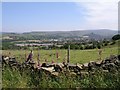
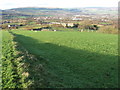
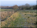
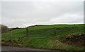
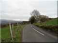
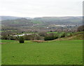
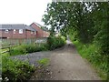
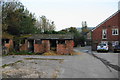
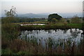
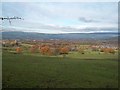
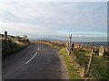
20 photos from this area
Area Information
Key information about the SK13 6YN including its size, population, and administrative classification.
- Area Type
- Postcode
- Area Size
- 3.2 hectares
- Population
- 1736
- Population Density
- 3449 people/km²
House Prices in SK13 6YN
59
Properties
£275,450
Average Sold Price
£60,950
Lowest Price
£565,050
Highest Price
Showing 59 properties
| Address | Type | Beds | Baths | Last Sale Price | Last Sale Date | |
|---|---|---|---|---|---|---|
| 42 Valley Road, Simmondley, Glossop, SK13 6YN | Detached | 4 | 3 | £545,000 | Nov 2025 | |
| 48 Valley Road, Simmondley, Glossop, SK13 6YN | Detached | 4 | 2 | £375,000 | Aug 2025 | |
| 39 Valley Road, Simmondley, Glossop, SK13 6YN | Detached | 3 | 2 | £385,000 | Jan 2025 | |
| 70 Valley Road, Simmondley, Glossop, SK13 6YN | Detached | 4 | 3 | £535,000 | Jan 2024 | |
| 26 Valley Road, Simmondley, Glossop, SK13 6YN | Detached | 4 | 2 | £465,000 | Nov 2023 | |
| 58 Valley Road, Simmondley, Glossop, SK13 6YN | Semi-detached | 3 | 2 | £350,000 | Oct 2023 | |
| 47 Valley Road, Simmondley, Glossop, SK13 6YN | Detached | 3 | 2 | £340,000 | Jun 2023 | |
| 32 Valley Road, Simmondley, Glossop, SK13 6YN | house | - | - | £565,050 | May 2022 | |
| 2 Valley Road, Simmondley, Glossop, SK13 6YN | house | - | - | £405,000 | Jun 2021 | |
| 17 Valley Road, Simmondley, Glossop, SK13 6YN | Detached | 3 | 2 | £305,000 | Jun 2021 |
Page 1 of 6
Energy Efficiency in SK13 6YN
Amenities
Schools
| Rank | School | Type | Entry gender | Ages |
|---|
Explore more schools in this area
Go to Schools tabDemographics
Household Size
Family (3-5 people)
most common
Accommodation Type
Houses
most common
Tenure
93
majority
Ethnic Group
White
most common
Religion
N/A
most common
Household Composition
N/A
most common
Age
47
median
Adults (30-64 years)
most common
Household Deprivation
N/A
with no deprivation
NS-SEC
50
in Lower managerial occupations
Explore more demographic insights in this area
Go to Demographics tabPlanning
Planning Constraints
- Flood RiskPremium
- Ramsar Wetland SitesPremium
- Area of Outstanding Natural BeautyPremium
- Protected Nature ReservePremium
- Protected WoodlandPremium