Area Overview for SK13 5HA
Photos of SK13 5HA
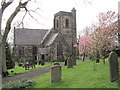
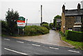
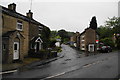
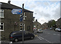
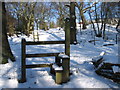
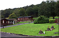
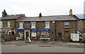
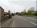
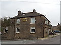
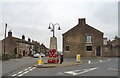
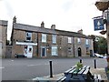
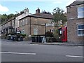
35 photos from this area
Area Information
Key information about the SK13 5HA including its size, population, and administrative classification.
- Area Type
- Postcode
- Area Size
- 3.2 hectares
- Population
- 1871
- Population Density
- 29 people/km²
House Prices in SK13 5HA
25
Properties
£242,204
Average Sold Price
£50,000
Lowest Price
£699,950
Highest Price
Showing 25 properties
| Address | Type | Beds | Baths | Last Sale Price | Last Sale Date | |
|---|---|---|---|---|---|---|
| 20 Town Lane, Charlesworth, SK13 5HA | house | 3 | 2 | £423,500 | Nov 2024 | |
| 12 Town Lane, Charlesworth, SK13 5HA | Terraced | 3 | 1 | £275,000 | Jan 2024 | |
| 18 Town Lane, Charlesworth, SK13 5HA | Terraced | 2 | 1 | £219,000 | Feb 2023 | |
| 3 Town Lane, Charlesworth, SK13 5HA | Terraced | 2 | 1 | £165,000 | Mar 2022 | |
| 1 Town Lane, Charlesworth, SK13 5HA | house | - | - | £145,000 | Nov 2021 | |
| 15 Town Lane, Charlesworth, SK13 5HA | house | - | - | £485,000 | Feb 2021 | |
| 5 Town Lane, Charlesworth, SK13 5HA | Terraced | 2 | 1 | £130,000 | Jul 2018 | |
| Homestead Farm, 19 Town Lane, Charlesworth, SK13 5HA | Detached | 6 | - | £699,950 | Jan 2016 | |
| 9 Town Lane, Charlesworth, SK13 5HA | Terraced | 2 | 1 | £115,000 | Aug 2004 | |
| 6 Town Lane, Charlesworth, SK13 5HA | Terraced | - | - | £69,000 | Nov 2001 |
Page 1 of 3
Energy Efficiency in SK13 5HA
Amenities
Schools
| Rank | School | Type | Entry gender | Ages |
|---|
Explore more schools in this area
Go to Schools tabDemographics
Household Size
Two person
most common
Accommodation Type
Houses
most common
Tenure
82
majority
Ethnic Group
White
most common
Religion
N/A
most common
Household Composition
N/A
most common
Age
47
median
Adults (30-64 years)
most common
Household Deprivation
N/A
with no deprivation
NS-SEC
43
in Lower managerial occupations
Explore more demographic insights in this area
Go to Demographics tabPlanning
Planning Constraints
- Flood RiskPremium
- Ramsar Wetland SitesPremium
- Area of Outstanding Natural BeautyPremium
- Protected Nature ReservePremium
- Protected WoodlandPremium