Area Overview for SK13 2RA
Photos of SK13 2RA
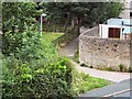
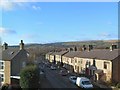
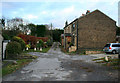
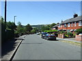
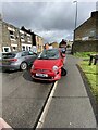
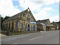
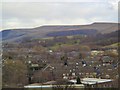
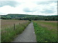
42 photos from this area
Area Information
Key information about the SK13 2RA including its size, population, and administrative classification.
- Area Type
- Postcode
- Area Size
- 7831 m²
- Population
- 1242
- Population Density
- 3604 people/km²
House Prices in SK13 2RA
13
Properties
£216,154
Average Sold Price
£98,000
Lowest Price
£460,000
Highest Price
Showing 13 properties
| Address | Type | Beds | Baths | Last Sale Price | Last Sale Date | |
|---|---|---|---|---|---|---|
| 3 Potter Road, Hadfield, Glossop, SK13 2RA | Detached | 4 | 3 | £460,000 | Oct 2025 | |
| 14 Potter Road, Hadfield, Glossop, SK13 2RA | Detached | 4 | 2 | £410,000 | Apr 2024 | |
| 9 Potter Road, Hadfield, Glossop, SK13 2RA | Detached | 5 | 2 | £315,000 | Oct 2015 | |
| 4 Potter Road, Hadfield, Glossop, SK13 2RA | house | - | - | £258,000 | Jan 2015 | |
| 8 Potter Road, Hadfield, Glossop, SK13 2RA | house | - | - | £240,000 | Oct 2013 | |
| 10 Potter Road, Hadfield, Glossop, SK13 2RA | Detached | - | - | £200,000 | Dec 2011 | |
| 6 Potter Road, Hadfield, Glossop, SK13 2RA | Detached | - | - | £233,000 | Oct 2005 | |
| 7 Potter Road, Hadfield, Glossop, SK13 2RA | Detached | - | - | £124,000 | Jul 1999 | |
| 5 Potter Road, Hadfield, Glossop, SK13 2RA | Detached | - | - | £98,000 | May 1997 | |
| 11 Potter Road, Hadfield, Glossop, SK13 2RA | Detached | 4 | 3 | £118,000 | Apr 1997 |
Page 1 of 2
Energy Efficiency in SK13 2RA
Amenities
Schools
| Rank | School | Type | Entry gender | Ages |
|---|
Explore more schools in this area
Go to Schools tabDemographics
Household Size
Two person
most common
Accommodation Type
Houses
most common
Tenure
91
majority
Ethnic Group
White
most common
Religion
N/A
most common
Household Composition
N/A
most common
Age
47
median
Adults (30-64 years)
most common
Household Deprivation
N/A
with no deprivation
NS-SEC
39
in Lower managerial occupations
Explore more demographic insights in this area
Go to Demographics tabPlanning
Planning Constraints
- Flood RiskPremium
- Ramsar Wetland SitesPremium
- Area of Outstanding Natural BeautyPremium
- Protected Nature ReservePremium
- Protected WoodlandPremium