Area Overview for SK13 1GE
Photos of SK13 1GE

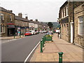
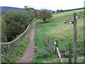
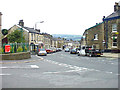
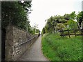
99 photos from this area
Area Information
Key information about the SK13 1GE including its size, population, and administrative classification.
- Area Type
- Postcode
- Area Size
- 2.3 hectares
- Population
- 1329
- Population Density
- 910 people/km²
House Prices in SK13 1GE
33
Properties
£179,896
Average Sold Price
£136,000
Lowest Price
£280,000
Highest Price
Showing 33 properties
| Address | Type | Beds | Baths | Last Sale Price | Last Sale Date | |
|---|---|---|---|---|---|---|
| 32 Rhodes Top, Padfield, Glossop, SK13 1GE | house | 2 | - | £185,000 | Aug 2021 | |
| 14 Rhodes Top, Padfield, Glossop, SK13 1GE | house | - | - | £215,000 | May 2021 | |
| 10 Rhodes Top, Padfield, Glossop, SK13 1GE | Detached | 3 | 3 | £280,000 | Jun 2020 | |
| 22 Rhodes Top, Padfield, Glossop, SK13 1GE | house | - | - | £162,000 | Aug 2019 | |
| 26 Rhodes Top, Padfield, Glossop, SK13 1GE | Terraced | 2 | 1 | £160,000 | Nov 2018 | |
| 11 Rhodes Top, Padfield, Glossop, SK13 1GE | Semi-detached | 3 | 2 | £175,000 | Nov 2018 | |
| 9 Rhodes Top, Padfield, Glossop, SK13 1GE | Terraced | 2 | 1 | £136,000 | Jan 2016 | |
| 4 Rhodes Top, Padfield, Glossop, SK13 1GE | house | - | - | £173,950 | Jul 2008 | |
| 30 Rhodes Top, Padfield, Glossop, SK13 1GE | Terraced | - | - | £148,950 | Feb 2008 | |
| 28 Rhodes Top, Padfield, Glossop, SK13 1GE | house | - | - | £214,955 | Oct 2007 |
Page 1 of 4
Energy Efficiency in SK13 1GE
Amenities
Schools
| Rank | School | Type | Entry gender | Ages |
|---|
Explore more schools in this area
Go to Schools tabDemographics
Household Size
Two person
most common
Accommodation Type
Houses
most common
Tenure
74
majority
Ethnic Group
White
most common
Religion
N/A
most common
Household Composition
N/A
most common
Age
47
median
Adults (30-64 years)
most common
Household Deprivation
N/A
with no deprivation
NS-SEC
43
in Lower managerial occupations
Explore more demographic insights in this area
Go to Demographics tabPlanning
Planning Constraints
- Flood RiskPremium
- Ramsar Wetland SitesPremium
- Area of Outstanding Natural BeautyPremium
- Protected Nature ReservePremium
- Protected WoodlandPremium