Area Overview for SK12 6RH
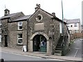
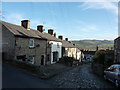
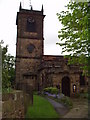
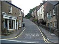
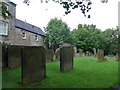
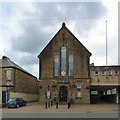
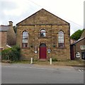
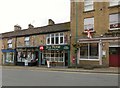
Photos of SK12 6RH
Area Information
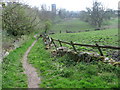
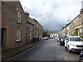
Living in SK12 6RH involves settling into a distinct postcodes cluster within Derbyshire. This specific area encompasses a small residential population of 2,064 people, creating a tight-knit rather than sprawling community. You will find yourself in an environment defined by stability and established character, far removed from the transient nature of major development zones. The median age here stands at 47 years, which signals a neighbourhood where residents are likely looking to stay long-term rather than driven by short-term speculation. Daily life centres on the immediate surroundings of Chapel-en-le-Frith, where the postcode serves as a marker for a quiet, suburban settlement. There is no large-scale commercial hub directly within the boundary, meaning your routine revolves around local stops and short travels to nearby towns. The area offers a reprieve from city noise, providing a background of calm for those prioritising peace over urban convenience. Homebuyers visiting SK12 6RH should expect a landscape of well-established dwellings rather than new build estates. This demographic reality ensures that the streets are populated by people with deep local roots, fostering a sense of familiarity and continuity.
- Area Type
- Postcode
- Area Size
- Not available
- Population
- 2064
- Population Density
- 3046 people/km²
The housing market in SK12 6RH is characterised by a strong preference for self-ownership. With 69% of residents owning their homes, this area functions primarily as an owner-occupied zone rather than a lettings hub. This statistic highlights that the majority of the stock consists of long-term family residences rather than investor properties. The accommodation type is exclusively houses, meaning you will not find converted flats or purpose-built apartments within this specific boundary. This homogeneity appeals to buyers seeking a traditional suburban lifestyle with a garden and private space. The high ownership percentage implies that prices may reflect the value of a mortgage-free asset for many local families, potentially driving values up relative to rental yields. For those looking at SK12 6RH, the focus shifts entirely to property value retention rather than rental income generation. The small population size of 2,064 limits the volume of transactions, which can mean properties stay on the market longer due to fewer potential bidders in this narrow postcode. Buyers should treat this as a boutique market where each sale impacts the local community directly.
House Prices in SK12 6RH
No properties found in this postcode.
Energy Efficiency in SK12 6RH
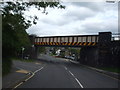
A typical day in SK12 6RH involves a journey of about 20 minutes to local amenities in Chapel-en-le-Frith. Your weekly shop is easily accessible at Co-op Chapel-En-Le, Morrisons Chapel en le, or Aldi Chapel en le, all located within practical reach. These three major retailers form the backbone of local spending, ensuring you do not need to travel far for groceries or household essentials. For railway commuters, public transport requires a short trip to nearby stations such as Chapel, Chinley Railway Station, or Dove Holes Railway Station. Five rail connections serve the immediate vicinity, linking the residential cluster to the wider transport network. This setup supports a hybrid lifestyle where you can enjoy quiet living but retain access to urban centres when required. The lack of bars, cinemas, or public parks listed in the immediate data confines evening social life to the home or a trip to the town centre. You will find the character of this lifestyle to be quiet and self-reliant, with convenience achieved through proximity to the main town rather than having every facility on-site.
Amenities
Schools
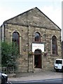
Families in SK12 6RH generally look outside the immediate postcode for local education, as the area contains no state schools listed within its boundaries. The nearest alternatives are specific specialist institutions including High Peak & Dales Support Centre and Step Forward Educational Trust. High Peak & Dales Support Centre operates as a centre focused on special educational needs, providing tailored support for students requiring additional assistance. Step Forward Educational Trust functions as an independent educational establishment, offering an alternative curriculum model to the state sector. The absence of traditional comprehensive or primary schools within the radius means residents must plan travel to clinics or fringe areas for daily education routines. This mix of specialist and independent options suggests that the immediate demographic may already include children with specific learning requirements or opt-out choices. Prospective homebuyers must factor in transport links to these specific venues when considering a move into SK12 6RH. You cannot rely on a standard catchment area for schooling within this specific address.
| Rank | School | Type | Entry gender | Ages |
|---|
Explore more schools in this area
Go to Schools tabDemographics
The community in SK12 6RH is overwhelmingly composed of adults between the ages of 30 and 64 years. This age group forms the core of the population, reflecting a shift away from families with very young children towards a demographic seeking stability. Sixty-nine per cent of residents own their homes outright or through a mortgage, indicating a high level of financial commitment to the area. This ownership rate suggests that the local economy relies heavily on wealthier established households rather than a transient rental market. The accommodation type is strictly houses, which aligns with the adult-focused age profile. There is no presence of apartment blocks or high-density flats in this specific postcode area. White British residents form the predominant ethnic group, mirroring the historical and geographical demographics of the wider Peak District region. The area does not show signs of recent rapid migration or significant demographic shifts. This stability means you are entering a neighbourhood where social norms and community expectations are well-settled. The lack of data on specific deprivation metrics means we cannot comment on income inequality, but the high home ownership rate generally implies a secure base for residents.
Household Size
Accommodation Type
Tenure
Ethnic Group
Religion
Household Composition
Age
Household Deprivation
NS-SEC
Explore more demographic insights in this area
Go to Demographics tabPlanning
Planning Constraints
- Flood RiskPremium
- Ramsar Wetland SitesPremium
- Area of Outstanding Natural BeautyPremium
- Protected Nature ReservePremium
- Protected WoodlandPremium