Area Overview for Shottle and Postern
Photos of Shottle and Postern


Area Information
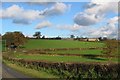
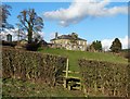
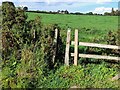
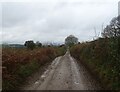
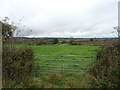
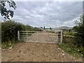
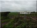
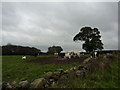
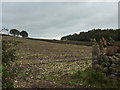
Shottle and Postern is a rural civil parish covering 15.4 square kilometres, located in England. The area functions primarily as a small community rather than a major town centre, offering a distinct slow-paced lifestyle away from urban congestion. Living in Shottle and Postern means accepting a countryside setting where resident character is defined by a large proportion of people who have settled permanently. Unlike rapidly expanding commuter belts, this parish maintains a modest footprint. The population dynamic suggests stability, as there is no indication of a young professional influx typical of new-build developments. Instead, the daily rhythm revolves around local estates and established neighbourhoods rather than transient housing schemes. Prospective buyers should understand that Shottle and Postern is a defined geographical unit within a larger district, not a standalone metropolitan hub. The small size of the parish limits the variety of local amenities found in larger boroughs. You will need to travel to nearby towns for extensive shopping or specialist services. The area is pronounced by its identity as a traditional parish, providing a sense of continuity that appeals to those seeking permanence over convenience. If your priority is quiet, established surroundings with clear boundaries, Shottle and Postern delivers exactly that.
- Area Type
- Parish
- Area Size
- 15.4 km²
- Population
- Not available
- Population Density
- Not available
Demographics
The community in Shottle and Postern reflects a settled population with a median age of 70 years. This indicates that the area is dominated by older residents, likely those who have lived here for decades or moved specifically for retirement. Over 86% of households in the area are owner-occupied, which creates a stable, long-term residential environment. This high ownership rate implies that most families or individuals have decided to stay, reducing turnover and fostering deep community ties. Accommodation types are standard for the region, though the specific breakdown between detached, semi-detached, and terraced housing is not detailed in the available records. The demographic profile suggests a low-deprivation environment where residents have significant autonomy over their homes. There is no evidence of a young family influx or a transient workforce typically found in market towns near industrial zones. Instead, the community comprises established households. The social fabric is likely woven from neighbours who know each other well due to the high ownership percentage and older age profile. Living here means joining a community where stability is the norm. You may find fewer annual home sales and a quieter social scene compared to areas with a younger median age.
Household Size
Accommodation Type
Tenure
Ethnic Group
Religion
Household Composition
Age
Household Deprivation
NS-SEC
Explore more demographic insights in this area
Go to Demographics tabPlanning
Planning Constraints
- Flood RiskLocked
- Ramsar Wetland SitesLocked
- Area of Outstanding Natural BeautyLocked
- Protected Nature ReserveLocked
- Protected WoodlandLocked
- Crime RiskLocked