Area Overview for Shirland and Stonebroom
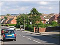
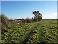
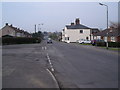
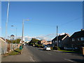
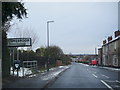
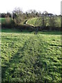
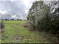
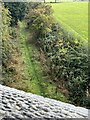
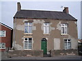
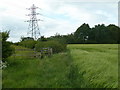
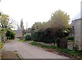
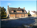
Photos of Shirland and Stonebroom
Area Information
Shirland and Stonebroom occupies a defined built-up area covering 1.4 square kilometres within England. This locality functions as a distinct residential community with a clear identity separate from larger urban centres. The footprint is compact enough to foster a sense of locality while maintaining separation from the wider regional infrastructure. Residents here experience life in a concentrated setting that prioritises domestic settlement over industrial activity. Living in Shirland and Stonebroom offers a settled environment characterised by established housing. The area does not sprawl indefinitely; instead, it presents a focused residential zone where neighbours know one another. Daily life revolves around the practicalities of a self-contained community where amenities are within a reachable distance. You can walk to the nearest railway stations or visit local shops without relying heavily on long commutes. The character of homes in Shirland and Stonebroom reflects a history of family life and stability. This built-up area attracts buyers seeking a straightforward residential address without the complications of mixed-use zoning. The density is moderate, avoiding the congestion found in city centres while preventing the isolation of remote villages. You will find a community where the pace of life moves at a steady rhythm. The 1.4 km² boundary creates a neighbourhood feel that remains intact despite being part of the broader East Midlands housing market. Prospective buyers will find the geography is compact and logically organised for those planning to settle down.
- Area Type
- Built Up Area 250
- Area Size
- 1.4 km²
- Population
- Not available
- Population Density
- Not available
Daily life in Shirland and Stonebroom benefits from a convenient selection of retail and travel amenities within easy reach. Residents have five retail locations available for shopping needs, with Asda Adastra, Spar, and Farmfoods Alfreton serving as the primary venues for groceries and essentials. You can complete your weekly shop without driving far, as these stores are situated nearby to the built-up area. This access to large supermarkets like Asda means you do not rely on small local shops for bulk items. Transport convenience is further enhanced by the presence of three railway stations within practical reach of your home. Alfreton Railway Station, Whatstandwell Railway Station, and Ambergate Railway Station offer regular services that connect you to wider destinations. Whether you need to travel for business or visit family, these transport hubs are integrated into your daily routine. The proximity of these stations means you can leave the car in the driveway and still travel easily. The combination of retail chains and rail access defines the lifestyle here as pragmatic and self-contained. You do not need to venture into larger towns for essentials. The availability of Spar and Farmfoods alongside the major supermarket ensures you have choices for different price points and product ranges. Living in this area means balancing the convenience of local shopping with the mobility provided by the rail lines. This mix supports a lifestyle where you can enjoy the quiet of a 1.4 km² neighbourhood while remaining connected to the region's employment opportunities.
Amenities
Schools
Families considering Shirland and Stonebroom have access to several primary education options within practical reach. The nearest educational institutions include Shirland Primary School, which serves as one of the main entry points for young children in the immediate vicinity. Stonebroom Primary and Nursery School operates nearby, offering combined primary education and nursery care to support early development. You can also find Edward Revell Primary School, another key institution serving the surrounding locality. These schools are all of the primary type, indicating that no secondary schools are immediately located within a walking distance of this specific 1.4 km² area. Parents must plan transport arrangements to move children between primary students and the nearest secondary education facilities outside the immediate neighbourhood. The school catchment areas likely extend beyond the small footprint of Shirland and Stonebroom itself. For younger children, the presence of nursery facilities at Stonebroom Primary and Nursery School provides a seamless transition into formal schooling. The concentration of primary schools suggests this area is recognised by families across a wider district as a catchment zone for early education. While there are no secondary academies or comprehensive schools listed directly inside the boundary, the proximity of multiple primaries offers convenience for those with young offspring. You should verify specific catchment boundaries and Ofsted ratings for each named school before making a purchase decision based on proximity alone. The list confirms three distinct primary options, though one entry for Stonebroom is repeated in the data, leaving three unique primary institutions for your consideration.
| Rank | School | Type | Entry gender | Ages |
|---|
Explore more schools in this area
Go to Schools tabDemographics
The community in Shirland and Stonebroom reflects an established settlement with a median age of 70 years. This figure indicates a population dominated by older residents who have lived in the area for many years. The demographic profile suggests a retirement community or a location that attracts pensioners seeking a quiet home. Families with young children form a smaller proportion of the total household composition compared to the geriatric cohort. Home ownership is the norm for residents here, with 68 per cent of houses occupied by their owners. This high level of tenure stability means you are more likely to encounter long-term inhabitants than landlords managing rental properties. The remaining 32 per cent of homes are occupied by tenants, but the overwhelming majority of people have access to a property without paying monthly rents to an agent. This ownership rate contributes to a stable social fabric where neighbours invest in their surroundings. Accommodation types in Shirland and Stonebroom support this owner-occupied majority through traditional housing stock suited to older lifestyles. The ethnic and religious breakdown of the population focuses on the total population rather than highlighting minority percentages, reflecting a homogenous demographic. You will find a community where decisions are made by those who have chosen to stay. The low proportion of younger households suggests limited new development aimed at first-time buyers. Instead, the housing market serves those seeking permanence. The age structure dictates the local demand, with fewer teenagers and more retirees shaping the local services and social activities.
Household Size
Accommodation Type
Tenure
Ethnic Group
Religion
Household Composition
Age
Household Deprivation
NS-SEC
Explore more demographic insights in this area
Go to Demographics tabPlanning
Planning Constraints
- Crime RiskPremium