Area Overview for Shireoaks
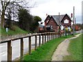
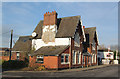
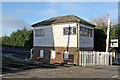
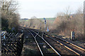
Photos of Shireoaks


Area Information
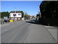
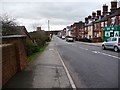
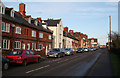
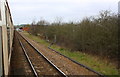
Shireoaks is a compact built-up area in England, spanning 71.3 hectares. It is a community defined by its older demographic, with a median age of 70, suggesting a population that may be more established or retired. The area’s home ownership rate of 78% indicates a strong presence of long-term residents, many of whom may have lived in the area for decades. Daily life here is likely shaped by proximity to essential services, including five nearby rail stations and retail outlets such as Sainsburys and Asda in Worksop. The area’s small size means amenities are within practical reach, though it lacks the density of larger urban centres. For those seeking a quieter, stable environment with access to transport and shopping, Shireoaks offers a straightforward, no-frills lifestyle. Its location near Worksop and Kiveton Park adds connectivity to surrounding areas, while the low crime risk score of 74 suggests a generally safe environment. Living in Shireoaks may appeal to those prioritising security, convenience, and a slower pace of life over bustling urban amenities.
- Area Type
- Built Up Area 250
- Area Size
- 71.3 hectares
- Population
- Not available
- Population Density
- Not available
The lifestyle in Shireoaks is shaped by its proximity to practical amenities. Within walking or short driving distance are five retail outlets, including Sainsburys and Asda in Worksop, providing access to groceries, household items, and services. The rail network, with five nearby stations, offers convenient travel to surrounding areas, whether for work, leisure, or socialising. While the area lacks detailed data on parks or leisure facilities, the presence of retail and transport options suggests a focus on functionality over luxury. The character of daily life here is likely straightforward, with an emphasis on accessibility and convenience. Residents can enjoy a mix of shopping, transport, and the relative quiet of a smaller community. However, those seeking extensive green spaces or cultural amenities may need to look beyond Shireoaks for a broader range of leisure activities.
Amenities
Schools
The nearest school to Shireoaks is St Luke’s CofE (Aided) Primary School, a primary school with an Ofsted rating of ‘good’. This rating indicates that the school meets national standards in teaching quality, pupil outcomes, and leadership. While the data does not list additional schools, the presence of a single primary school with a positive rating may be a key consideration for families. The absence of secondary schools or other educational institutions in the immediate vicinity means parents may need to look further afield for secondary education. However, the proximity of St Luke’s suggests that primary schooling is accessible within the area. For families prioritising a strong foundation in early education, this school could be a significant draw for Shireoaks.
| Rank | A + A* % | School | Type | Entry gender | Ages |
|---|---|---|---|---|---|
| 1 | N/A | St Luke's CofE (Aided) Primary School | primary | N/A | N/A |
Explore more schools in this area
Go to Schools tabDemographics
Shireoaks has a median age of 70, the highest figure recorded, indicating a population skewed towards older adults. This suggests a community with a significant proportion of retired individuals or those in later life stages. The home ownership rate of 78% is notably high, reflecting a stable, long-term resident base. The data does not specify household composition or accommodation types, but the overall home ownership percentage implies a predominance of owner-occupied properties. The area’s demographic profile, with no breakdown of ethnic groups or religious affiliations, suggests a homogenous population, though this is not explicitly stated. The high median age may influence local services, with healthcare and community centres likely tailored to older residents. For buyers, this demographic could mean a quieter, less transient neighbourhood, though it may also limit opportunities for younger families seeking schools or childcare facilities.
Household Size
Accommodation Type
Tenure
Ethnic Group
Religion
Household Composition
Age
Household Deprivation
NS-SEC
Explore more demographic insights in this area
Go to Demographics tabPlanning
Planning Constraints
- Crime RiskLocked