Area Overview for Shirebrook South Ward
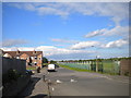
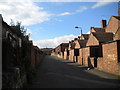
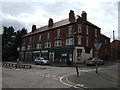
Photos of Shirebrook South Ward

Area Information
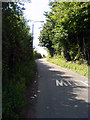
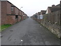
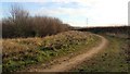
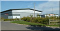
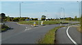
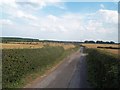
Living in Shirebrook South Ward offers a distinct rural character within the Bolsover District of Derbyshire. This electoral ward covers exactly 4.6 km² of southern Shirebrook, situated near the B6407 road and close to the main A632 artery linking Mansfield, Worksop, and Bolsover. As one of the oldest parts of the town, the area sits at approximately 53.1931°N, 1.2133°W, providing a quiet setting just on the border with Nottinghamshire. Daily life here revolves around a specific set of community hubs, including the Shirebrook Methodist Church, the Victoria Inn, and the Carter Lane Community Centre, which serve as key polling locations and social gathering spots. The ward functions as a compact neighbourhood defined by its postcode NG20 8 dominance and proximity to the wider regional network. You will find a location that balances local village amenities with direct access to the broader East Midlands via established road links. The area represents a settled part of Shirebrook where residents enjoy the convenience of being part of a definitive town boundary without the centre of the busy urban sprawl. Your daily commute would benefit from the A632 connection, allowing easy travel toward Nottinghamshire districts while remaining rooted in this specific civil parish.
- Area Type
- District Borough Unitary Ward
- Area Size
- 4.6 km²
- Population
- Not available
- Population Density
- Not available
Demographics
The community in Shirebrook South Ward is defined by a distinctly mature population profile. With a median age of 70 years, the residents are significantly older than the national average. This demographic structure characterises Shirebrook South Ward as a retirement-friendly or semi-retirement location where lifestyle revolves around stability and quiet living. A high proportion of the population falls into the 'Total' age category, indicating a broad spread across older life stages rather than a concentrated youth population. This age distribution shapes local services, meaning you should anticipate a community where neighbours likely share similar life experiences and leisure interests. The area reflects a settled demographic where long-term residency is the norm, creating an environment prioritised for peace over nightlife or modern urban growth. When considering homes in this area, you are entering a deeply established environment where the local social fabric has evolved around this specific older demographic. The lack of a huge youth population means schools and family-centric amenities may not dominate your neighbourhood view compared to other eastern regions. Instead, the social rhythm matches the human rhythm of a population that has chosen this specific 4.6 km² stretch for its tranquillity.
Household Size
Accommodation Type
Tenure
Ethnic Group
Religion
Household Composition
Age
Household Deprivation
NS-SEC
Explore more demographic insights in this area
Go to Demographics tabPlanning
Planning Constraints
- Flood RiskPremium
- Ramsar Wetland SitesPremium
- Area of Outstanding Natural BeautyPremium
- Protected Nature ReservePremium
- Crime RiskPremium