Area Overview for Seagrave
Photos of Seagrave

Area Information
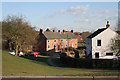
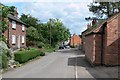
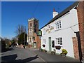
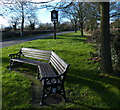
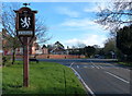
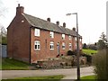
Seagrave is a compact built-up area in England, covering 36.1 hectares and home to a population that skews older, with a median age of 70. This suggests a community rooted in stability, with many residents likely to have lived in the area for decades. The high home ownership rate of 84% reinforces a sense of permanence, contrasting with areas where rental markets dominate. Daily life here is shaped by proximity to essential services, with nearby retail options like Morrisons and Tesco within practical reach. The area’s modest size means it is likely to feel close-knit, though its character is defined by the balance between residential living and the availability of transport links. For those considering homes in Seagrave, the combination of low crime risk and accessible amenities may appeal to buyers seeking a quieter, secure environment without sacrificing connectivity to nearby towns and cities.
- Area Type
- Built Up Area 250
- Area Size
- 36.1 hectares
- Population
- Not available
- Population Density
- Not available
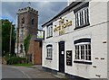
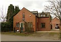
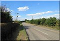
Seagrave’s lifestyle is defined by its proximity to essential amenities, including retail hubs like Morrisons Daily, Tesco Sileby, and Co-op Barrow upon Soar. These stores provide access to groceries, household goods, and everyday conveniences within walking or short driving distance. The area’s rail and metro stations connect residents to nearby towns, expanding opportunities for leisure, shopping, and employment. While the data does not specify parks or recreational spaces, the availability of transport links suggests that residents can easily access green spaces or cultural attractions in surrounding areas. The combination of local shops and transport options supports a practical, community-focused lifestyle, where daily needs are met without the need for long commutes.
Amenities
Schools
Seagrave’s primary school, Seagrave Village Primary School, is a key local institution with an Ofsted rating of ‘good’. This provides families with a locally accessible option for early education, though the data does not list secondary schools or other educational institutions. The presence of a primary school with a positive rating may be a significant factor for families prioritising proximity to schools. However, the lack of information on higher education or specialist provision means parents may need to look further afield for secondary schooling. For those considering Seagrave, the school’s performance offers reassurance about the quality of education available, though further research would be needed to assess the full range of educational opportunities in the area.
| Rank | School | Type | Entry gender | Ages |
|---|
Explore more schools in this area
Go to Schools tabDemographics
Seagrave’s population has a median age of 70, indicating a community where older residents predominate. This age profile suggests a demographic that may be more established, with fewer young families or transient populations. The home ownership rate of 84% is notably high, reflecting a market where most properties are owner-occupied rather than rented. This could imply a stable housing market with long-term residents. Accommodation types and household compositions are not specified in detail, but the data highlights that the predominant ethnic group and religious affiliations are not provided, meaning broader diversity metrics are not available. For those prioritising a low-deprivation environment, the lack of specific deprivation data means assumptions about quality of life must be made cautiously. The area’s character is clearly shaped by its older demographic, which may influence local services and community dynamics.
Household Size
Accommodation Type
Tenure
Ethnic Group
Religion
Household Composition
Age
Household Deprivation
NS-SEC
Explore more demographic insights in this area
Go to Demographics tabPlanning
Planning Constraints
- Crime RiskPremium