Area Overview for Scraptoft
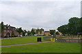
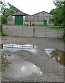
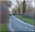
Photos of Scraptoft

Area Information
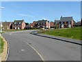
Living in Scraptoft means residing in a civil parish situated in England with a defined geographical footprint of 5.3 kilometres². This area offers a distinct living environment that draws on its specific boundaries and local administrative structure. You will find a settlement that has developed into a tight-knit community with a clear sense of place. The parish itself serves as the primary unit for local governance and community organisation. Residents here navigate a landscape that balances rural character with local connectivity. Daily life in Scraptoft revolves around the parish boundaries which define the extent of local services and neighbourhood interaction. The area's size influences how far you might need to travel for certain amenities outside the immediate vicinity. Homebuyers seeking homes in Scraptoft will discover an environment where the physical scale of the parish shapes the rhythm of everyday activities. The community functions within these 5.3 sq km, creating a manageable scale for residents to know their neighbours. This location presents a straightforward profile for those assessing a move. The civil parish status provides a structured framework for understanding local planning and community decisions. You can expect a setting where local identity remains strong within its recognised boundaries. Scraptoft stands as a defined part of the region with its own administrative character.
- Area Type
- Parish
- Area Size
- 5.3 km²
- Population
- Not available
- Population Density
- Not available
Demographics
The community in Scraptoft reflects a mature population profile with significant implications for daily life in the area. The median age stands at 70 years, indicating an older demographic that shapes the local atmosphere and available services. Most residents fall into age categories typical of established homeowners rather than families with young children or young professionals entering the workforce. Home ownership reaches a striking 83 per cent within Scraptoft. This high level suggests a population with long-standing roots and financial stability in the parish. The majority of people live in their own homes rather than renting, which often translates to lower property turnover and stable neighbourhoods. Such a composition impacts how quickly new residents integrate into the community compared to areas with higher rental rates. Accommodation types and household compositions align with this older, owner-occupied demographic. You will find that many houses have been held by the same families over several decades. The diversity data indicates a comprehensive breakdown of the population across all groupings, though specific ethnic or religious breakdowns are not separately detailed in the core metrics. The social structure here is defined by tenure stability rather than transient living arrangements. For anyone looking at homes in Scraptoft, the demographic reality points to a quiet, settled environment. The age profile and ownership rates create a predictable living dynamic where neighbours are likely to be long-term residents. This stability offers a consistent environment for those who prefer established communities over rapidly changing neighbourhoods.
Household Size
Accommodation Type
Tenure
Ethnic Group
Religion
Household Composition
Age
Household Deprivation
NS-SEC
Explore more demographic insights in this area
Go to Demographics tabPlanning
Planning Constraints
- Flood RiskPremium
- Ramsar Wetland SitesPremium
- Area of Outstanding Natural BeautyPremium
- Protected Nature ReservePremium
- Protected WoodlandPremium
- Crime RiskPremium