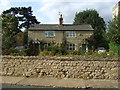
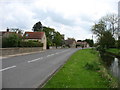
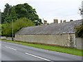
Area Overview for Scopwick
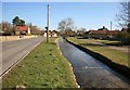
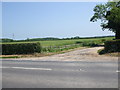
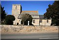
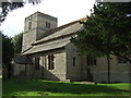
Photos of Scopwick


Area Information
Living in Scopwick offers a distinct blend of small-town charm and practicality. As a built-up area spanning 26.9 hectares, it is compact yet well-served by nearby amenities. The community here is characterised by a median age of 70, reflecting a population skewed towards older residents. This demographic shape influences the area’s pace of life, with a focus on stability and accessibility. Scopwick’s proximity to two railway stations—Metheringham and Ruskington—ensures reasonable links to surrounding towns, while five retail outlets, including Lincolnshire Co-operative Co and Spar, provide essential shopping options. The area’s safety is a notable draw, with a crime risk score of 94, indicating below-average crime rates. For those considering homes in Scopwick, the combination of low crime, accessible transport, and a tight-knit community makes it a viable option for buyers seeking a quieter, well-connected location. The broadband score of 88 ensures reliable internet connectivity, supporting both daily use and remote work. While the population is older, the area’s infrastructure and amenities cater to a range of needs, making it a practical choice for those prioritising safety and convenience.
- Area Type
- Built Up Area 250
- Area Size
- 26.9 hectares
- Population
- Not available
- Population Density
- Not available
Scopwick’s lifestyle is defined by its proximity to essential amenities within practical reach. The area’s two railway stations—Metheringham and Ruskington—provide direct access to regional transport networks, facilitating travel to nearby towns and cities. For shopping, residents have five nearby retail options, including Lincolnshire Co-operative Co and Spar, ensuring easy access to groceries and daily necessities. While the data does not specify dining or leisure facilities, the presence of multiple retail outlets suggests a focus on convenience rather than extensive entertainment options. The compact nature of the area means that amenities are closely grouped, reducing the need for lengthy journeys. This setup supports a low-stress lifestyle, particularly for older residents who may prioritise ease of access over expansive recreational spaces. The absence of detailed information on parks or leisure facilities means that those seeking active lifestyles may need to look beyond Scopwick for such amenities. Nonetheless, the area’s practical reach and accessible services make it suitable for those valuing simplicity and reliability in daily life.
Amenities
Schools
| Rank | School | Type | Entry gender | Ages |
|---|
Explore more schools in this area
Go to Schools tabDemographics
Scopwick’s demographic profile is defined by its median age of 70, the highest in the dataset, suggesting a community predominantly composed of older residents. This age profile influences local dynamics, with a focus on services and amenities suited to mature populations. Home ownership stands at 63%, indicating a mix of owner-occupied properties and rental units. The data does not specify household types or accommodation categories, but the overall home ownership rate suggests a stable, long-term resident base. The area’s population size is not explicitly stated, but its compact 26.9-hectare footprint implies a small, closely knit community. The absence of detailed diversity or religious statistics means no conclusions can be drawn about cultural or ethnic composition. However, the safety score of 94—reflecting low crime risk—suggests a secure environment, which may appeal to retirees or those seeking a peaceful lifestyle. The combination of age demographics and safety metrics positions Scopwick as a place where stability and accessibility are prioritised over rapid change.
Household Size
Accommodation Type
Tenure
Ethnic Group
Religion
Household Composition
Age
Household Deprivation
NS-SEC
Explore more demographic insights in this area
Go to Demographics tabPlanning
Planning Constraints
- Crime RiskPremium