Area Overview for S80 4PE
Photos of S80 4PE
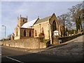
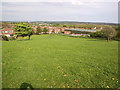
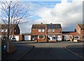
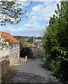
82 photos from this area
Area Information
Key information about the S80 4PE including its size, population, and administrative classification.
- Area Type
- Postcode
- Area Size
- 1.1 hectares
- Population
- 1447
- Population Density
- 510 people/km²
House Prices in S80 4PE
18
Properties
£189,636
Average Sold Price
£128,000
Lowest Price
£249,950
Highest Price
Showing 18 properties
| Address | Type | Beds | Baths | Last Sale Price | Last Sale Date | |
|---|---|---|---|---|---|---|
| 16 Bakestone Moor, Whitwell, S80 4PE | Bungalow | 3 | 1 | £220,000 | May 2025 | |
| 20 Bakestone Moor, Whitwell, S80 4PE | house | 3 | 2 | £202,000 | Jun 2021 | |
| 24 Bakestone Moor, Whitwell, S80 4PE | Detached | - | - | £235,000 | Mar 2018 | |
| Olive House, 22A Bakestone Moor, Whitwell, S80 4PE | house | - | - | £145,000 | Sep 2009 | |
| 22 Bakestone Moor, Whitwell, S80 4PE | Bungalow | - | - | £249,950 | Jun 2007 | |
| 18 Bakestone Moor, Whitwell, S80 4PE | Semi-detached | - | - | £128,000 | Mar 2005 | |
| 28 Bakestone Moor, Whitwell, S80 4PE | Detached | - | - | £147,500 | Sep 2002 | |
| 44 Bakestone Moor, Whitwell, S80 4PE | Bungalow | 3 | 1 | - | - | |
| 38 Bakestone Moor, Whitwell, S80 4PE | Bungalow | - | - | - | - | |
| 26 Bakestone Moor, Whitwell, S80 4PE | Detached | - | - | - | - |
Page 1 of 2
Energy Efficiency in S80 4PE
Amenities
Schools
| Rank | School | Type | Entry gender | Ages |
|---|
Explore more schools in this area
Go to Schools tabDemographics
Household Size
Two person
most common
Accommodation Type
Houses
most common
Tenure
70
majority
Ethnic Group
White
most common
Religion
N/A
most common
Household Composition
N/A
most common
Age
47
median
Adults (30-64 years)
most common
Household Deprivation
N/A
with no deprivation
NS-SEC
27
in Lower managerial occupations
Explore more demographic insights in this area
Go to Demographics tabPlanning
Planning Constraints
- Flood RiskPremium
- Ramsar Wetland SitesPremium
- Area of Outstanding Natural BeautyPremium
- Protected Nature ReservePremium
- Protected WoodlandPremium