Area Overview for S80 3AD
Photos of S80 3AD


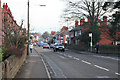
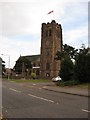
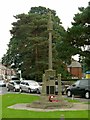
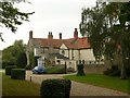
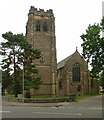
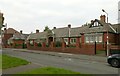
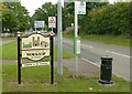
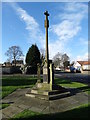
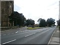
35 photos from this area
Area Information
Key information about the S80 3AD including its size, population, and administrative classification.
- Area Type
- Postcode
- Area Size
- 1.9 hectares
- Population
- 1684
- Population Density
- 136 people/km²
House Prices in S80 3AD
24
Properties
£159,104
Average Sold Price
£33,000
Lowest Price
£397,000
Highest Price
Showing 24 properties
| Address | Type | Beds | Baths | Last Sale Price | Last Sale Date | |
|---|---|---|---|---|---|---|
| 20 Mansfield Road, Worksop, S80 3AD | Semi-detached | 3 | 2 | £231,000 | Aug 2025 | |
| 2 Mansfield Road, Worksop, S80 3AD | Detached | 3 | 1 | £140,000 | Jun 2021 | |
| 30 Mansfield Road, Worksop, S80 3AD | Semi-detached | 3 | - | £196,000 | Dec 2020 | |
| 38 Mansfield Road, Worksop, S80 3AD | house | - | - | £397,000 | Oct 2020 | |
| 26 Mansfield Road, Worksop, S80 3AD | Semi-detached | 3 | 2 | £175,000 | May 2020 | |
| 4 Mansfield Road, Worksop, S80 3AD | Semi-detached | 3 | 1 | £181,500 | Apr 2020 | |
| 40 Mansfield Road, Worksop, S80 3AD | Bungalow | 2 | 1 | £215,000 | Aug 2019 | |
| 24 Mansfield Road, Worksop, S80 3AD | Semi-detached | 3 | 1 | £187,000 | May 2019 | |
| 44 Mansfield Road, Worksop, S80 3AD | house | - | - | £137,500 | May 2017 | |
| 28 Mansfield Road, Worksop, S80 3AD | house | - | - | £196,500 | Apr 2010 |
Page 1 of 3
Energy Efficiency in S80 3AD
Amenities
Schools
| Rank | School | Type | Entry gender | Ages |
|---|
Explore more schools in this area
Go to Schools tabDemographics
Household Size
Two person
most common
Accommodation Type
Houses
most common
Tenure
89
majority
Ethnic Group
White
most common
Religion
N/A
most common
Household Composition
N/A
most common
Age
47
median
Adults (30-64 years)
most common
Household Deprivation
N/A
with no deprivation
NS-SEC
41
in Lower managerial occupations
Explore more demographic insights in this area
Go to Demographics tabPlanning
Planning Constraints
- Flood RiskPremium
- Ramsar Wetland SitesPremium
- Area of Outstanding Natural BeautyPremium
- Protected Nature ReservePremium
- Protected WoodlandPremium