Area Overview for S80 2HB
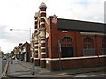
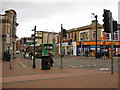
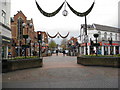
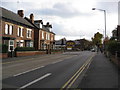
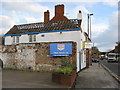
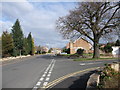
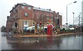
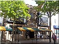
Photos of S80 2HB
Area Information
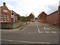
Living in S80 2HB offers a residence within a compact residential cluster that spans just 2,172 square metres. This small postcode area serves as a tight-knit focal point for a defined population of 1,874 residents. You are situated in a specific English residential zone, where the physical boundaries are clear and the community is proportionally dense. The local environment is characterised by its limited footprint, resulting in a living experience where neighbours are likely to be close at hand. Daily life here revolves around this concentrated settlement, which functions as a distinct unit within the broader Worksop region. The area size restricts large-scale development, preserving a neighbourhood feel that differs from sprawling urban districts. Prospective buyers should expect a setting where the immediate surroundings are intimate and the sense of place is derived from the concentration of homes and the specific identity of S80 2HB. This location provides a grounded environment where community interactions are natural due to the small scale of the housing estate. You can anticipate a lifestyle where the conveniences of a village or estate ground floor, with immediate access to local services and a defined sense of belonging.
- Area Type
- Postcode
- Area Size
- 2172 m²
- Population
- 1874
- Population Density
- 2703 people/km²
The housing stock in S80 2HB is primarily composed of houses, which shapes the market for anyone seeking properties in this specific postcode. With 38 per cent of the population in ownership, the area maintains a mixed balance of owner-occupiers and private renters. You are looking at a market where the majority of dwellings are not purpose-built flats, offering a different living dynamic compared to high-density urban blocks. This dominance of houses suggests that buyers typically seek single-story or two-story private residences rather than shared housing or converted blocks. The limited area size of 2,172 square metres constrains the total volume of available properties, meaning competition for suitable homes in S80 2HB could be focused on a smaller pool. Potential buyers must navigate a market where every dwelling carries significant value due to the scarcity of land within such a small residential cluster. The lower ownership rate compared to some rural estates indicates a healthy rental sector, providing entry points for those who have not yet purchased.
House Prices in S80 2HB
No properties found in this postcode.
Energy Efficiency in S80 2HB
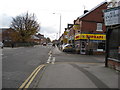
Daily amenities in S80 2HB are concentrated within practical reach, offering essential retail and transport links without requiring lengthy commutes. For shoppers, there are five major retail points nearby, including Asda Worksop, Farmfoods St Anne's, and Iceland Worksop. These saturated options provide everything from supermarket essentials to clerk-friendly budget purchase means. Transport connectivity is equally accessible, with five rail stations identified as nearest points of access, including Worksop Railway Station, Shireoaks Railway Station, and Whitwell Railway Station. This variety of rail stations allows residents of S80 2HB to choose the most convenient station for their specific travel destination. Living here means you can conduct weekly grocery runs or catch a railway service with minimal disruption to your schedule. The availability of multiple large retail outlets and varied transport nodes ensures that lifestyle needs are met efficiently within the immediate estate boundaries.
Amenities
Schools
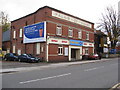
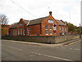
Education options near S80 2HB include Abbey CofE Junior School and Abbey CofE Infant School, both situated in close proximity to the postcode. These two institutions serve as the primary educational facilities for young residents living in the immediate area. Abbey CofE Junior School caters to mid-to-late primary years, while Abbey CofE Infant School covers the earliest stages of education. The presence of Church of England schools indicates a faith-based curriculum which may influence educational outcomes for families in S80 2HB. For families considering homes in this area, having both nursery and junior provision locally simplifies the commute for collecting children from school. This concentration of primary education supports households with young to middle-stage children who do not need to travel further afield for basic schooling. The specific naming convention, such as the inclusion of 'Abbey', reflects the local geographical identifiers that tie the schools to the wider worksop landscape.
| Rank | School | Type | Entry gender | Ages |
|---|
Explore more schools in this area
Go to Schools tabDemographics
The community in S80 2HB is defined by an established resident base with a median age of 47 years. The prevailing demographic consists of adults aged between 30 and 64 years, indicating a stable population rather than transient mobility. You can expect to meet a community where the average household head is well beyond their early twenties, suggesting a focus on stability and long-term settlement. Housing preferences align with this age profile, as the predominant accommodation type is houses rather than flats or purpose-built apartments. This structural choice supports a lifestyle that often includes families or individuals seeking more space for private living areas. Home ownership stands at 38 per cent, meaning that while many residents are tied to their properties, a significant portion of the population remains in the rental market. The resident population is predominantly White, reflecting the traditional demographic makeup of the region. Living in S80 2HB means engaging with a neighbourhood where homeownership and renting coexist, but the architectural style remains consistent with single-family or semi-detached dwellings.
Household Size
Accommodation Type
Tenure
Ethnic Group
Religion
Household Composition
Age
Household Deprivation
NS-SEC
Explore more demographic insights in this area
Go to Demographics tabPlanning
Planning Constraints
- Flood RiskPremium
- Ramsar Wetland SitesPremium
- Area of Outstanding Natural BeautyPremium
- Protected Nature ReservePremium
- Protected WoodlandPremium