Area Overview for S45 0LH
Photos of S45 0LH
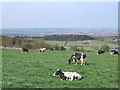
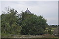
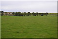
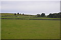
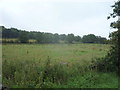
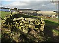
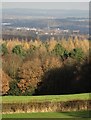
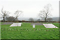
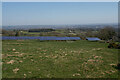
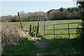
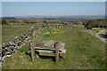
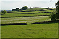
37 photos from this area
Area Information
Key information about the S45 0LH including its size, population, and administrative classification.
- Area Type
- Postcode
- Area Size
- 91.2 hectares
- Population
- 1959
- Population Density
- 51 people/km²
House Prices in S45 0LH
21
Properties
£55,000
Average Sold Price
£55,000
Lowest Price
£55,000
Highest Price
Showing 21 properties
| Address | Type | Beds | Baths | Last Sale Price | Last Sale Date | |
|---|---|---|---|---|---|---|
| Rose Cottage, Highashes Lane, Ashover, S45 0LH | Detached | - | - | £55,000 | Sep 1996 | |
| Spitewinter Cottage, Highashes Lane, Ashover, S45 0LH | Mobile Home | 2 | 1 | - | - | |
| High Ashes Farm, Highashes Lane, Ashover, S45 0LH | office_workshop | - | - | - | - | |
| Span Carr Farm, Highashes Lane, Ashover, S45 0LH | house | - | - | - | - | |
| Hurst House, Highashes Lane, Ashover, S45 0LH | house | - | - | - | - | |
| Spitewinter Cottage Farm, Highashes Lane, Ashover, S45 0LH | house | - | - | - | - | |
| The Stables, Highashes Lane, Ashover, S45 0LH | Detached | - | - | - | - | |
| The Bungalow, Yewcrofts Farm, Highashes Lane, Ashover, S45 0LH | Detached | - | - | - | - | |
| Hazelhurst Farm, Highashes Lane, Ashover, S45 0LH | house | - | - | - | - | |
| The Cowhouse, Yewcrofts Farm, Highashes Lane, Ashover, S45 0LH | Detached | - | - | - | - |
Page 1 of 3
Energy Efficiency in S45 0LH
Amenities
Schools
| Rank | School | Type | Entry gender | Ages |
|---|
Explore more schools in this area
Go to Schools tabDemographics
Household Size
Two person
most common
Accommodation Type
Houses
most common
Tenure
79
majority
Ethnic Group
White
most common
Religion
N/A
most common
Household Composition
N/A
most common
Age
47
median
Adults (30-64 years)
most common
Household Deprivation
N/A
with no deprivation
NS-SEC
41
in Lower managerial occupations
Explore more demographic insights in this area
Go to Demographics tabPlanning
Planning Constraints
- Flood RiskPremium
- Ramsar Wetland SitesPremium
- Area of Outstanding Natural BeautyPremium
- Protected Nature ReservePremium
- Protected WoodlandPremium