Area Overview for S44 9AE
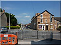
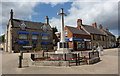
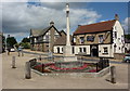
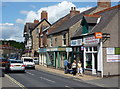
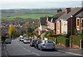
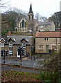
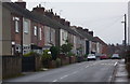
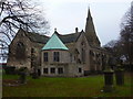
Photos of S44 9AE


Area Information
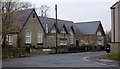
S44 9AE stands as a specific residential cluster within England, distinguished by its high concentration of households. The area accommodates a population of 2,040 people, resulting in a density of 1,656 people per square kilometre. This figure places S44 9AE among the more urbanised clusters in its locality. Living in S44 9AE means navigating a space where homes are situated in close proximity, creating an environment that lacks the sprawling distance found in more rural settings. The area is defined by its small scale yet significant resident count, which shapes the daily rhythm of the neighbourhood. Prospective buyers should note that this postcode covers a small residential cluster rather than a vast district. The compact nature of S44 9AE ensures that daily needs are often within walking distance, but it also implies a busy backdrop to domestic life.
- Area Type
- Postcode
- Area Size
- Not available
- Population
- 2040
- Population Density
- 1656 people/km²
The housing landscape in S44 9AE is almost entirely composed of houses. This distinction sets it apart from areas featuring significant terraced or apartment stock. With 59% of the population owning their homes, the area operates more like a built community of stewards than a rental corridor. This high ownership figure suggests that homes in S44 9AE often have long-term ties to specific families. When viewing properties, expect detached or semi-detached structures suited to the local greengirdle. The small area size of this postcode means that the total number of transactions remains limited compared to larger boroughs. Buyers looking at homes in S44 9AE should appreciate the stability this ownership model brings to the streets. The market here is less about speculative investment and more about settling into a neighbourhood with clear architecture and resident continuity.
House Prices in S44 9AE
No properties found in this postcode.
Energy Efficiency in S44 9AE
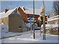
Daily provisions for residents of S44 9AE come from a cluster of amenities located within practical reach. Five retail outlets serve the local shopping needs, including Morrisons Bolsover, Farmfoods Bolsover, and the Co-op Duckmanton. These options provide a solid range of groceries and essentials without requiring long journeys. Transport links extend five rail miles away to stations at Langwith, Creswell, and Shirebrook Railway Station. These railheads offer access to wider networks for commuters heading beyond the immediate area. A bus station is also available nearby, adding another layer of public transit flexibility. While the area lacks dedicated leisure parks or football grounds in its immediate vicinity, the nearby towns of Bolsover and Duckmanton fill that gap. You will find enough shops to run errands easily, but significant leisure activities may require a short drive to neighbouring towns.
Amenities
Schools
| Rank | School | Type | Entry gender | Ages |
|---|
Explore more schools in this area
Go to Schools tabDemographics
The community within S44 9AE reflects a mature profile, with a median age of 47 years. Most residents fall into the 30-64 years age bracket, creating a neighbourhood dominated by working families and established adults. Household dynamics show a strong preference for permanence, as 59% of residents own their homes. This ownership rate stands in contrast to areas driven by private renting. Houses form the primary accommodation type, indicating a stock designed for families or those seeking traditional living spaces. You will find that the demographic makeup is predominantly White, mirroring the wider county's composition. The age distribution suggests a stable community where residents have likely raised families or built careers over several decades. This concentration of owners in their 40s and 50s points to a market characterised by established households rather than transient populations.
Household Size
Accommodation Type
Tenure
Ethnic Group
Religion
Household Composition
Age
Household Deprivation
NS-SEC
Explore more demographic insights in this area
Go to Demographics tabPlanning
Planning Constraints
- Flood RiskPremium
- Ramsar Wetland SitesPremium
- Area of Outstanding Natural BeautyPremium
- Protected Nature ReservePremium
- Protected WoodlandPremium