Area Overview for S44 6SW
Photos of S44 6SW
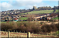
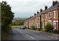
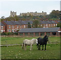
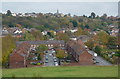
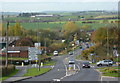
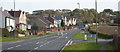
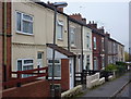
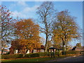
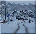
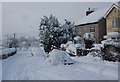
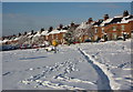
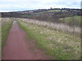
100 photos from this area
Area Information
Key information about the S44 6SW including its size, population, and administrative classification.
- Area Type
- Postcode
- Area Size
- 2.1 hectares
- Population
- 2040
- Population Density
- 1656 people/km²
House Prices in S44 6SW
44
Properties
£123,063
Average Sold Price
£53,950
Lowest Price
£450,000
Highest Price
Showing 44 properties
| Address | Type | Beds | Baths | Last Sale Price | Last Sale Date | |
|---|---|---|---|---|---|---|
| 41 Nursery Drive, Bolsover, S44 6SW | Detached | 3 | 1 | £195,000 | Sep 2025 | |
| 16 Nursery Drive, Bolsover, S44 6SW | Semi-detached | 3 | 1 | £157,000 | Aug 2024 | |
| 53 Nursery Drive, Bolsover, S44 6SW | Detached | 3 | 1 | £230,000 | Mar 2024 | |
| 35 Nursery Drive, Bolsover, S44 6SW | Semi-detached | 2 | 1 | £139,950 | Jan 2024 | |
| 18 Nursery Drive, Bolsover, S44 6SW | Semi-detached | 2 | 1 | £130,000 | Sep 2023 | |
| 6 Nursery Drive, Bolsover, S44 6SW | house | - | - | £70,000 | Apr 2023 | |
| 5 Nursery Drive, Bolsover, S44 6SW | house | - | - | £150,000 | Jan 2022 | |
| 65 Nursery Drive, Bolsover, S44 6SW | Semi-detached | 3 | 1 | £165,000 | Dec 2021 | |
| 49 Nursery Drive, Bolsover, S44 6SW | house | - | - | £135,750 | May 2021 | |
| 21 Nursery Drive, Bolsover, S44 6SW | house | - | - | £155,000 | Mar 2021 |
Page 1 of 5
Energy Efficiency in S44 6SW
Amenities
Schools
| Rank | School | Type | Entry gender | Ages |
|---|
Explore more schools in this area
Go to Schools tabDemographics
Household Size
Two person
most common
Accommodation Type
Houses
most common
Tenure
59
majority
Ethnic Group
White
most common
Religion
N/A
most common
Household Composition
N/A
most common
Age
47
median
Adults (30-64 years)
most common
Household Deprivation
N/A
with no deprivation
NS-SEC
19
in Lower managerial occupations
Explore more demographic insights in this area
Go to Demographics tabPlanning
Planning Constraints
- Flood RiskPremium
- Ramsar Wetland SitesPremium
- Area of Outstanding Natural BeautyPremium
- Protected Nature ReservePremium
- Protected WoodlandPremium