Area Overview for S44 6JJ
Photos of S44 6JJ
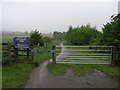
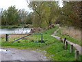
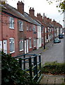

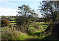
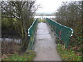
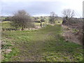
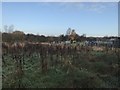
80 photos from this area
Area Information
Key information about the S44 6JJ including its size, population, and administrative classification.
- Area Type
- Postcode
- Area Size
- 1.3 hectares
- Population
- 1447
- Population Density
- 1497 people/km²
House Prices in S44 6JJ
42
Properties
£72,250
Average Sold Price
£15,000
Lowest Price
£120,000
Highest Price
Showing 42 properties
| Address | Type | Beds | Baths | Last Sale Price | Last Sale Date | |
|---|---|---|---|---|---|---|
| 69 Sutton Hall Road, Carr Vale, Bolsover, S44 6JJ | Terraced | 2 | 1 | £120,000 | Oct 2025 | |
| 25 Sutton Hall Road, Carr Vale, Bolsover, S44 6JJ | Terraced | 2 | 1 | £70,000 | May 2025 | |
| 85 Sutton Hall Road, Carr Vale, Bolsover, S44 6JJ | Terraced | 3 | - | £80,000 | Mar 2025 | |
| 45 Sutton Hall Road, Carr Vale, Bolsover, S44 6JJ | Terraced | 2 | 1 | £80,000 | Mar 2025 | |
| 23 Sutton Hall Road, Carr Vale, Bolsover, S44 6JJ | Terraced | 2 | 1 | £104,000 | Nov 2024 | |
| 7 Sutton Hall Road, Carr Vale, Bolsover, S44 6JJ | Terraced | 2 | 1 | £96,000 | Mar 2024 | |
| 13 Sutton Hall Road, Carr Vale, Bolsover, S44 6JJ | Terraced | 2 | 1 | £120,000 | Mar 2024 | |
| 31 Sutton Hall Road, Carr Vale, Bolsover, S44 6JJ | Terraced | 3 | 2 | £120,000 | Mar 2023 | |
| 15 Sutton Hall Road, Carr Vale, Bolsover, S44 6JJ | house | 2 | 1 | £90,000 | Aug 2022 | |
| 37 Sutton Hall Road, Carr Vale, Bolsover, S44 6JJ | house | 2 | 1 | £115,000 | Jun 2022 |
Page 1 of 5
Energy Efficiency in S44 6JJ
Amenities
Schools
| Rank | School | Type | Entry gender | Ages |
|---|
Explore more schools in this area
Go to Schools tabDemographics
Household Size
One person
most common
Accommodation Type
Houses
most common
Tenure
47
majority
Ethnic Group
White
most common
Religion
N/A
most common
Household Composition
N/A
most common
Age
47
median
Adults (30-64 years)
most common
Household Deprivation
N/A
with no deprivation
NS-SEC
19
in Lower managerial occupations
Explore more demographic insights in this area
Go to Demographics tabPlanning
Planning Constraints
- Flood RiskPremium
- Ramsar Wetland SitesPremium
- Area of Outstanding Natural BeautyPremium
- Protected Nature ReservePremium
- Protected WoodlandPremium