Area Overview for S44 6DW
Photos of S44 6DW
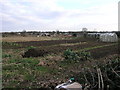
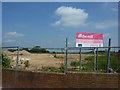
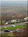
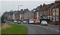
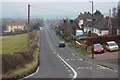
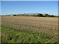
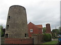
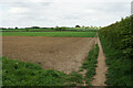
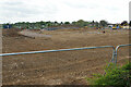

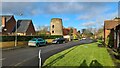
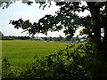
27 photos from this area
Area Information
Key information about the S44 6DW including its size, population, and administrative classification.
- Area Type
- Postcode
- Area Size
- 36.3 hectares
- Population
- 1300
- Population Density
- 250 people/km²
House Prices in S44 6DW
23
Properties
£197,569
Average Sold Price
£48,100
Lowest Price
£370,000
Highest Price
Showing 23 properties
| Address | Type | Beds | Baths | Last Sale Price | Last Sale Date | |
|---|---|---|---|---|---|---|
| Long Acre, Oxcroft Lane, Bolsover, S44 6DW | Bungalow | 2 | 1 | £290,000 | Nov 2023 | |
| Whytewebs, Oxcroft Lane, Bolsover, S44 6DW | Detached | 3 | 2 | £370,000 | Dec 2019 | |
| La Rondine, Oxcroft Lane, Bolsover, S44 6DW | Bungalow | 3 | 1 | £232,500 | Feb 2017 | |
| 195 Oxcroft Lane, Bolsover, S44 6DW | Detached | 4 | 2 | £249,999 | Jun 2012 | |
| Brockley, Oxcroft Lane, Bolsover, S44 6DW | Bungalow | - | - | £163,000 | Nov 2011 | |
| 185 Oxcroft Lane, Bolsover, S44 6DW | Semi-detached | 2 | - | £129,950 | Jan 2007 | |
| 183 Oxcroft Lane, Bolsover, S44 6DW | Semi-detached | 2 | 1 | £97,000 | May 2006 | |
| Wyndcroft, Oxcroft Lane, Bolsover, S44 6DW | Bungalow | - | - | £48,100 | Jun 1998 | |
| 71 Oxcroft Lane, Bolsover, S44 6DW | Detached | 3 | 1 | - | - | |
| Sutherland Farm, Oxcroft Lane, Bolsover, S44 6DW | Detached | 4 | 2 | - | - |
Page 1 of 3
Energy Efficiency in S44 6DW
Amenities
Schools
| Rank | School | Type | Entry gender | Ages |
|---|
Explore more schools in this area
Go to Schools tabDemographics
Household Size
Two person
most common
Accommodation Type
Houses
most common
Tenure
60
majority
Ethnic Group
White
most common
Religion
N/A
most common
Household Composition
N/A
most common
Age
47
median
Adults (30-64 years)
most common
Household Deprivation
N/A
with no deprivation
NS-SEC
28
in Lower managerial occupations
Explore more demographic insights in this area
Go to Demographics tabPlanning
Planning Constraints
- Flood RiskPremium
- Ramsar Wetland SitesPremium
- Area of Outstanding Natural BeautyPremium
- Protected Nature ReservePremium
- Protected WoodlandPremium