Area Overview for S44 5YS
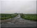
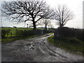
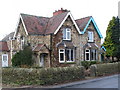
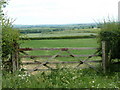
Photos of S44 5YS


Area Information
S44 5YS represents a specific residential cluster in England with a defined character shaped by its modest population and stable demographics. This postcode area is home to 1,636 residents, creating a community where proximity is a genuine feature of daily life rather than a marketing descriptor. The location sits at a population density of 112 people per square kilometre, which suggests a spread of housing that avoids the high-pressure commute environments found in major urban centres. Living in S44 5YS often means a quieter existence where the rhythm of life is dictated less by rush hour traffic and more by local necessity. The area functions as a self-contained node within the wider region, offering a sense of closure that appeals to those seeking a foothold outside of metropolitan hubs. You will find oneself in a setting where the scale of development is intentionally restrained, focusing on residential utility over commercial grandeur. This environment suits individuals who prioritise accessibility and community interaction over the anonymity of a crowded city block. The lack of extensive commercial infrastructure within the immediate postcode boundary means that residents rely slightly more on nearby towns for significant shopping or leisure activities.
- Area Type
- Postcode
- Area Size
- Not available
- Population
- 1636
- Population Density
- 112 people/km²
Homes in S44 5YS exist within a market dominated by owner-occupiers, with 73% of residents holding title to their property. This statistic reveals an area where the housing stock is not primarily driven by short-term letting or investment speculation. The predominant accommodation type is houses, which means the landscape is less likely to feature high-rise flats or purpose-built student accommodation. For buyers, this presents an environment where properties are often sized for families or older couples rather than single professional occupants. The concentration of owners suggests that when properties do change hands, they are typically sold between residents who understand the specific character of the street. Because the area is a small residential cluster covering only a specific postcode, inventory levels may be lower than in larger towns. This scarcity can mean that opportunities to purchase a home require patience and vigilance. The market reflects a traditional approach to housing availability, where local transactions outweigh national chain activity. If you are looking for a leasehold flat or high-density living, your search must extend beyond the immediate boundaries of S44 5YS.
House Prices in S44 5YS
No properties found in this postcode.
Energy Efficiency in S44 5YS
Daily life in S44 5YS benefits from a network of amenities that are within practical reach, although significant shopping and leisure options lie just beyond the immediate postcode boundary. You have access to five notable retail locations, including Asda Heath, Co-op Duckmanton, and Asda Markham. These supermarkets provide the essential goods needed for weekly shopping without the need to travel into city centres, supporting a lifestyle that values convenience. Transport links are similarly structured around accessibility to main hubs rather than local mini-hops. There are three rail stations available nearby, specifically Chesterfield Railway Station, Langwith, and Shirebrook Railway Station. These stations offer connections that extend your daily radius significantly, linking you to larger employment centres and regional destinations. A coach station also serves the area, providing an alternative for those without access to a car or for occasional longer distance travel. This combination of rail and coach infrastructure means that living in S44 5YS does not necessitate permanent car ownership, though a vehicle remains the most practical solution for accessing clusters of amenities. The presence of key retailers like the Co-op and Asda networks ensures that daily errands can be completed efficiently, blending rural quiet with urban utility.
Amenities
Schools
For families living in S44 5YS, the primary educational option listed is Arkwright Primary School. This institution is situated nearby and holds a current Ofsted rating of satisfactory. While the data does not provide details on secondary schools, Arkwright serves as the foundational educational step for local children. A satisfactory rating from Ofsted indicates that the school meets the required standards for education and care, though it does not demonstrate outstanding achievement in specific subjects. The presence of a primary school within practical reach means that you do not need to rely solely on transportation arrangements for early education, a significant consideration for parents who work local hours. The option is currently limited to this one primary school in the immediate vicinity, which means you may need to secure a place early or consider neighbouring districts for secondary education. This single-school reality defines the local start to a child's academic journey and requires families to be proactive about admissions processes. The school's performance is a baseline for the area, ensuring that the next generation receives a compliant education while potentially prompting residents to supplement with private tutoring or explore wider local options later on.
| Rank | School | Type | Entry gender | Ages |
|---|
Explore more schools in this area
Go to Schools tabDemographics
The community in S44 5YS is defined by stability, with a median age of 47 years marking the demographic heart of the neighbourhood. Adults aged between 30 and 64 years represent the most common age range, indicating that this area attracts families in their prime earning and raising years or mature professionals establishing their retirement homes. A substantial 73% of households report home ownership, a figure that signals deep roots and long-term commitment to the locality rather than a transient rental culture. Most residents live in houses, which aligns with the area's low density and provides private living spaces that suit the profile of the median age. The predominant ethnic group is White, reflecting a homogenous community that has likely evolved over several generations. This demographic profile suggests a neighbourhood where social networks are established and familiar to new arrivals. The age distribution implies a lower volume of young children attending primary school compared to areas with a younger median age, yet the presence of school-aged children remains a standard part of life. Home ownership rates here are notably high, often correlating with quieter streets and more stable local governance.
Household Size
Accommodation Type
Tenure
Ethnic Group
Religion
Household Composition
Age
Household Deprivation
NS-SEC
Explore more demographic insights in this area
Go to Demographics tabPlanning
Planning Constraints
- Flood RiskPremium
- Ramsar Wetland SitesPremium
- Area of Outstanding Natural BeautyPremium
- Protected Nature ReservePremium
- Protected WoodlandPremium