Area Overview for S44 5JL
Photos of S44 5JL


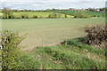
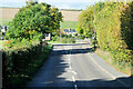
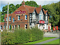


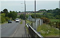
20 photos from this area
Area Information
Key information about the S44 5JL including its size, population, and administrative classification.
- Area Type
- Postcode
- Area Size
- 17.0 hectares
- Population
- 1400
- Population Density
- 397 people/km²
House Prices in S44 5JL
53
Properties
£133,535
Average Sold Price
£44,950
Lowest Price
£258,000
Highest Price
Showing 53 properties
| Address | Type | Beds | Baths | Last Sale Price | Last Sale Date | |
|---|---|---|---|---|---|---|
| 47 Cherry Tree Drive, Duckmanton, S44 5JL | Semi-detached | 3 | 1 | £219,000 | Oct 2025 | |
| 32 Cherry Tree Drive, Duckmanton, S44 5JL | Detached | 3 | 2 | £230,000 | Sep 2024 | |
| 17 Cherry Tree Drive, Duckmanton, S44 5JL | Semi-detached | 2 | 1 | £160,000 | Feb 2024 | |
| 26 Cherry Tree Drive, Duckmanton, S44 5JL | Detached | 3 | 1 | £227,500 | Oct 2023 | |
| 45 Cherry Tree Drive, Duckmanton, S44 5JL | Semi-detached | 3 | 1 | £185,000 | Jul 2023 | |
| 41 Cherry Tree Drive, Duckmanton, S44 5JL | Semi-detached | 2 | 1 | £167,000 | Jul 2023 | |
| 46 Cherry Tree Drive, Duckmanton, S44 5JL | Semi-detached | 2 | 1 | £174,500 | Mar 2023 | |
| 25 Cherry Tree Drive, Duckmanton, S44 5JL | Detached | 3 | 1 | £205,000 | Jan 2022 | |
| 9 Cherry Tree Drive, Duckmanton, S44 5JL | house | - | - | £192,000 | Sep 2021 | |
| 15 Cherry Tree Drive, Duckmanton, S44 5JL | Detached | 3 | 1 | £207,000 | Sep 2021 |
Page 1 of 6
Energy Efficiency in S44 5JL
Amenities
Schools
| Rank | School | Type | Entry gender | Ages |
|---|
Explore more schools in this area
Go to Schools tabDemographics
Household Size
Family (3-5 people)
most common
Accommodation Type
Houses
most common
Tenure
58
majority
Ethnic Group
White
most common
Religion
N/A
most common
Household Composition
N/A
most common
Age
47
median
Adults (30-64 years)
most common
Household Deprivation
N/A
with no deprivation
NS-SEC
19
in Lower managerial occupations
Explore more demographic insights in this area
Go to Demographics tabPlanning
Planning Constraints
- Flood RiskPremium
- Ramsar Wetland SitesPremium
- Area of Outstanding Natural BeautyPremium
- Protected Nature ReservePremium
- Protected WoodlandPremium