Area Overview for S44 5EJ
Photos of S44 5EJ


Area Information
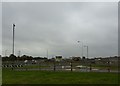
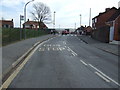
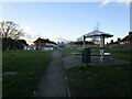
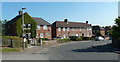
Living in S44 5EJ means settling into a compact residential cluster defined by its modest scale and settled character. This specific postcode covers an area of just 6436 square metres, housing a population of approximately 1400 people. You will find that the density here works out to 397 people per square kilometre, creating a quiet environment without the isolation of completely rural settings. The predominant ethnic group within this area is White, which reflects the established nature of the neighbourhood. Daily life centres on a community where neighbours likely know one another well due to the small size of the housing estate. This postcode represents a specific slice of a larger residential zone, likely offering a mix of terraced and semi-detached homes typical of the region. For buyers, the area offers a tangible sense of place where the number of homes is limited and the footprints of the dwellings are close together. This makes it suitable for those seeking a low-traffic environment with a clear focus on family homes rather than high-density living. The area stands as a distinct pocket within the broader landscape, offering stability and a clear sense of locality for anyone looking to settle down in this part of Derbyshire.
- Area Type
- Postcode
- Area Size
- 6436 m²
- Population
- 1400
- Population Density
- 397 people/km²
You will find that the property market in S44 5EJ is dominated by houses, with no flats included in the stock for this specific postcode. This focus on detached and semi-detached properties shapes the investment landscape and the daily rhythm of the neighbourhood. The high home ownership rate of 58% indicates that buyers here have consistently chosen to purchase rather than rent, a trend that reinforces the stability of the local market. Owners make up the majority of the residents, suggesting low vacancy rates and a low churn of tenants moving in and out frequently. This dynamic creates a competitive environment for anyone looking to buy, as interest is largely driven by local settlers staying in their homes. There is no evidence of a student rental market or high transient population, which often depresses house prices in busy city locations. Instead, values here are likely linked to the quality of the specific house and its position relative to the 1400 residents living within this tight cluster. You are dealing with an area where long-term ownership is the norm rather than the exception.
House Prices in S44 5EJ
Showing 17 properties
| Address | Type | Beds | Baths | Last Sale Price | Last Sale Date | |
|---|---|---|---|---|---|---|
| 28 Poolsbrook Road, Duckmanton, S44 5EJ | Semi-detached | 4 | 3 | £145,000 | Apr 2017 | |
| 10 Poolsbrook Road, Duckmanton, S44 5EJ | Terraced | - | - | £61,000 | Jul 2007 | |
| 2 Poolsbrook Road, Duckmanton, S44 5EJ | house | - | - | £19,175 | Feb 2002 | |
| 30 Poolsbrook Road, Duckmanton, S44 5EJ | house | - | - | £29,000 | Nov 1995 | |
| Soul Scissors Hair And Beauty, Poolsbrook Road, Duckmanton, S44 5EJ | shop | - | - | - | - | |
| 24 Poolsbrook Road, Duckmanton, S44 5EJ | house | - | - | - | - | |
| 22 Poolsbrook Road, Duckmanton, S44 5EJ | Terraced | - | - | - | - | |
| 14 Poolsbrook Road, Duckmanton, S44 5EJ | Terraced | - | - | - | - | |
| 16 Poolsbrook Road, Duckmanton, S44 5EJ | house | - | - | - | - | |
| 18 Poolsbrook Road, Duckmanton, S44 5EJ | Terraced | - | - | - | - |
Energy Efficiency in S44 5EJ
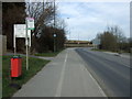
Your daily lifestyle in S44 5EJ benefits from a practical network of shops and transport hubs located within walking or short driving distance. For essential shopping, Asda Markham, Co-op Duckmanton, and Co-op Inkersall are the notable retail venues you should know about. These stores provide a good selection of groceries and household essentials without needing to travel far.Transport for your commute includes four nearby railway stations, specifically Chesterfield, Creswell, and Langwith, alongside a coach station that serves the broader network. The area also features Halfway Platform and Westfield as metro stops, giving you multiple ways to leave the locality quickly. While the data does not list parks or specific leisure centres, the presence of these major retailers and transport links ensures that you have access to a full range of services. You can rely on Co-op Duckmanton for your weekly shop and the train stations for your work travel. The layout supports a self-sufficient life where you do not need to travel into Derby centre for basic needs.
Amenities
Schools
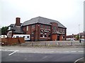
Families living near S44 5EJ have access to Duckmanton Primary School, which stands as the nearest educational facility listed for the area. This primary school holds a 'good' Ofsted rating, indicating that it meets high standards of educational quality and care for its pupils. While specific secondary options are not listed in the immediate data for this postcode, the presence of a well-regarded primary school suggests a solid foundation for younger children. You will likely find that families prioritise proximity and quality when choosing a home in S44 5EJ, making Duckmanton a key factor in property values. The single-school profile available in the data implies that this part of the catchment relies heavily on this one institution for early education. For parents moving into the area, checking the latest reports from Duckmanton Primary School will provide a clear picture of the education your children will receive. The rating confirms that the local education system supports childhood development effectively.
| Rank | School | Type | Entry gender | Ages |
|---|
Explore more schools in this area
Go to Schools tabDemographics
The community in S44 5EJ is defined by a mature demographic profile, making it an area where long-term residents hold significant sway over local affairs. The median age here is 47, which sits firmly within the adult range of 30 to 64 years. This data point explains why the area appeals to families and individuals established in their careers rather than young starter buyers or retirees. With a home ownership rate of 58%, you are more likely to meet owners paying mortgages or those who have already secured their debt-free status than tenants looking for short-term leases. The accommodation type is overwhelmingly houses, meaning you will not find flats or high-rise blocks among the stock in this postcode. There is no sharp diversity of cultures as the White ethnic group forms the clear majority of the population. Regarding deprivation, the absence of flagged data suggests average conditions, meaning residents do not face the acute financial struggles seen in more deprived zones. The 58% ownership figure further confirms that this is a stable market where families have rooted themselves over decades. You will encounter a community where professional decisions and family planning drive social interactions rather than transient student housing or low-income rentals.
Household Size
Accommodation Type
Tenure
Ethnic Group
Religion
Household Composition
Age
Household Deprivation
NS-SEC
Explore more demographic insights in this area
Go to Demographics tabPlanning
Planning Constraints
- Flood RiskPremium
- Ramsar Wetland SitesPremium
- Area of Outstanding Natural BeautyPremium
- Protected Nature ReservePremium
- Protected WoodlandPremium