Area Overview for S43 4WH
Photos of S43 4WH
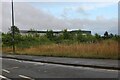
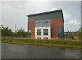
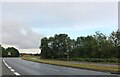
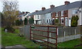
29 photos from this area
Area Information
Key information about the S43 4WH including its size, population, and administrative classification.
- Area Type
- Postcode
- Area Size
- 9667 m²
- Population
- 1500
- Population Density
- 127 people/km²
House Prices in S43 4WH
15
Properties
£243,913
Average Sold Price
£116,190
Lowest Price
£400,000
Highest Price
Showing 15 properties
| Address | Type | Beds | Baths | Last Sale Price | Last Sale Date | |
|---|---|---|---|---|---|---|
| 15 Winders Corner, Barlborough, S43 4WH | house | - | - | £400,000 | May 2022 | |
| 2 Winders Corner, Barlborough, S43 4WH | Detached | 4 | 1 | £325,000 | Nov 2019 | |
| 14 Winders Corner, Barlborough, S43 4WH | Detached | 4 | 2 | £275,000 | Sep 2019 | |
| 11 Winders Corner, Barlborough, S43 4WH | Detached | 4 | 2 | £261,500 | Oct 2016 | |
| 7 Winders Corner, Barlborough, S43 4WH | house | - | - | £300,000 | Oct 2015 | |
| 1 Winders Corner, Barlborough, S43 4WH | house | - | - | £242,500 | Apr 2013 | |
| 10 Winders Corner, Barlborough, S43 4WH | house | 5 | - | £240,000 | Sep 2011 | |
| 17 Winders Corner, Barlborough, S43 4WH | house | - | - | £225,000 | Aug 2011 | |
| 5 Winders Corner, Barlborough, S43 4WH | house | - | - | £242,000 | Dec 2006 | |
| 6 Winders Corner, Barlborough, S43 4WH | Detached | - | - | £218,000 | Aug 2005 |
Page 1 of 2
Energy Efficiency in S43 4WH
Amenities
Schools
| Rank | School | Type | Entry gender | Ages |
|---|
Explore more schools in this area
Go to Schools tabDemographics
Household Size
Two person
most common
Accommodation Type
Houses
most common
Tenure
86
majority
Ethnic Group
White
most common
Religion
N/A
most common
Household Composition
N/A
most common
Age
47
median
Adults (30-64 years)
most common
Household Deprivation
N/A
with no deprivation
NS-SEC
39
in Lower managerial occupations
Explore more demographic insights in this area
Go to Demographics tabPlanning
Planning Constraints
- Flood RiskPremium
- Ramsar Wetland SitesPremium
- Area of Outstanding Natural BeautyPremium
- Protected Nature ReservePremium
- Protected WoodlandPremium