Area Overview for S43 4FH
Photos of S43 4FH
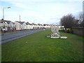
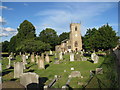
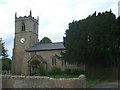
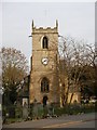
47 photos from this area
Area Information
Key information about the S43 4FH including its size, population, and administrative classification.
- Area Type
- Postcode
- Area Size
- 4615 m²
- Population
- 1475
- Population Density
- 357 people/km²
House Prices in S43 4FH
23
Properties
£118,248
Average Sold Price
£82,000
Lowest Price
£194,000
Highest Price
Showing 23 properties
| Address | Type | Beds | Baths | Last Sale Price | Last Sale Date | |
|---|---|---|---|---|---|---|
| 46 Vicarage Walk, Clowne, S43 4FH | Terraced | 2 | 1 | £150,000 | Nov 2025 | |
| 6 Vicarage Walk, Clowne, S43 4FH | Semi-detached | 3 | 2 | £170,000 | Jul 2022 | |
| 16 Vicarage Walk, Clowne, S43 4FH | Flat | 2 | - | £92,000 | Dec 2021 | |
| 8 Vicarage Walk, Clowne, S43 4FH | house | - | - | £194,000 | Dec 2020 | |
| 28 Vicarage Walk, Clowne, S43 4FH | Flat | - | - | £92,000 | May 2019 | |
| 40 Vicarage Walk, Clowne, S43 4FH | Maisonette | 1 | 1 | £82,000 | Oct 2018 | |
| 20 Vicarage Walk, Clowne, S43 4FH | Flat | - | - | £90,000 | May 2018 | |
| 34 Vicarage Walk, Clowne, S43 4FH | Flat | 2 | 1 | £85,000 | Jul 2016 | |
| 44 Vicarage Walk, Clowne, S43 4FH | Semi-detached | 2 | 2 | £114,995 | Mar 2016 | |
| 22 Vicarage Walk, Clowne, S43 4FH | Flat | 2 | 1 | £87,995 | Jan 2016 |
Page 1 of 3
Energy Efficiency in S43 4FH
Amenities
Schools
| Rank | School | Type | Entry gender | Ages |
|---|
Explore more schools in this area
Go to Schools tabDemographics
Household Size
Two person
most common
Accommodation Type
Houses
most common
Tenure
80
majority
Ethnic Group
White
most common
Religion
N/A
most common
Household Composition
N/A
most common
Age
47
median
Adults (30-64 years)
most common
Household Deprivation
N/A
with no deprivation
NS-SEC
35
in Lower managerial occupations
Explore more demographic insights in this area
Go to Demographics tabPlanning
Planning Constraints
- Flood RiskPremium
- Ramsar Wetland SitesPremium
- Area of Outstanding Natural BeautyPremium
- Protected Nature ReservePremium
- Protected WoodlandPremium