Area Overview for S43 3DP
Photos of S43 3DP
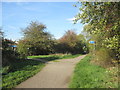
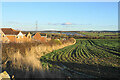

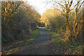
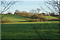
21 photos from this area
Area Information
Key information about the S43 3DP including its size, population, and administrative classification.
- Area Type
- Postcode
- Area Size
- 1.8 hectares
- Population
- 1446
- Population Density
- 1462 people/km²
House Prices in S43 3DP
32
Properties
£120,366
Average Sold Price
£30,000
Lowest Price
£193,500
Highest Price
Showing 32 properties
| Address | Type | Beds | Baths | Last Sale Price | Last Sale Date | |
|---|---|---|---|---|---|---|
| 52 Elliott Drive, Inkersall, S43 3DP | Bungalow | 2 | 1 | £165,000 | Feb 2019 | |
| 2B Elliott Drive, Inkersall, S43 3DP | Bungalow | 2 | 1 | £177,500 | Aug 2018 | |
| 30 Elliott Drive, Inkersall, S43 3DP | Bungalow | 2 | 1 | £115,000 | Aug 2014 | |
| 58 Elliott Drive, Inkersall, S43 3DP | Bungalow | 2 | 1 | £100,000 | Nov 2013 | |
| 36 Elliott Drive, Inkersall, S43 3DP | Bungalow | 3 | 1 | £143,000 | Jun 2013 | |
| 28 Elliott Drive, Inkersall, S43 3DP | Bungalow | - | - | £120,000 | Aug 2012 | |
| 44 Elliott Drive, Inkersall, S43 3DP | Bungalow | - | - | £110,000 | Apr 2012 | |
| 2A Elliott Drive, Inkersall, S43 3DP | Bungalow | - | - | £163,000 | Jul 2011 | |
| 54 Elliott Drive, Inkersall, S43 3DP | Bungalow | - | - | £115,000 | Oct 2010 | |
| 2 Elliott Drive, Inkersall, S43 3DP | Bungalow | - | - | £108,000 | Jun 2009 |
Page 1 of 4
Energy Efficiency in S43 3DP
Amenities
Schools
| Rank | School | Type | Entry gender | Ages |
|---|
Explore more schools in this area
Go to Schools tabDemographics
Household Size
Two person
most common
Accommodation Type
Houses
most common
Tenure
89
majority
Ethnic Group
White
most common
Religion
N/A
most common
Household Composition
N/A
most common
Age
47
median
Adults (30-64 years)
most common
Household Deprivation
N/A
with no deprivation
NS-SEC
29
in Lower managerial occupations
Explore more demographic insights in this area
Go to Demographics tabPlanning
Planning Constraints
- Flood RiskPremium
- Ramsar Wetland SitesPremium
- Area of Outstanding Natural BeautyPremium
- Protected Nature ReservePremium
- Protected WoodlandPremium