Area Overview for S43 2DF
Photos of S43 2DF

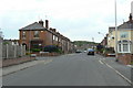

23 photos from this area
Area Information
Key information about the S43 2DF including its size, population, and administrative classification.
- Area Type
- Postcode
- Area Size
- 2.5 hectares
- Population
- 1419
- Population Density
- 3724 people/km²
House Prices in S43 2DF
55
Properties
£105,590
Average Sold Price
£30,000
Lowest Price
£175,000
Highest Price
Showing 55 properties
| Address | Type | Beds | Baths | Last Sale Price | Last Sale Date | |
|---|---|---|---|---|---|---|
| 82 Devonshire Avenue North, New Whittington, S43 2DF | house | 3 | - | £140,000 | Apr 2025 | |
| 72 Devonshire Avenue North, New Whittington, S43 2DF | Semi-detached | 2 | 1 | £130,000 | Apr 2025 | |
| 112 Devonshire Avenue North, New Whittington, S43 2DF | Semi-detached | 3 | 1 | £140,000 | Nov 2024 | |
| 11 Devonshire Avenue North, New Whittington, S43 2DF | Semi-detached | 2 | 1 | £130,000 | Aug 2023 | |
| 17 Devonshire Avenue North, New Whittington, S43 2DF | house | - | - | £123,000 | Aug 2023 | |
| 114 Devonshire Avenue North, New Whittington, S43 2DF | Semi-detached | 3 | 2 | £135,000 | Feb 2023 | |
| 25 Devonshire Avenue North, New Whittington, S43 2DF | Semi-detached | 2 | 1 | £131,000 | Jan 2023 | |
| 86 Devonshire Avenue North, New Whittington, S43 2DF | Terraced | 3 | 1 | £175,000 | May 2022 | |
| 29 Devonshire Avenue North, New Whittington, S43 2DF | house | - | - | £116,400 | Feb 2022 | |
| 70 Devonshire Avenue North, New Whittington, S43 2DF | Semi-detached | 3 | 1 | £145,000 | Jan 2021 |
Page 1 of 6
Energy Efficiency in S43 2DF
Amenities
Schools
| Rank | School | Type | Entry gender | Ages |
|---|
Explore more schools in this area
Go to Schools tabDemographics
Household Size
One person
most common
Accommodation Type
Houses
most common
Tenure
66
majority
Ethnic Group
White
most common
Religion
N/A
most common
Household Composition
N/A
most common
Age
47
median
Adults (30-64 years)
most common
Household Deprivation
N/A
with no deprivation
NS-SEC
25
in Lower managerial occupations
Explore more demographic insights in this area
Go to Demographics tabPlanning
Planning Constraints
- Flood RiskPremium
- Ramsar Wetland SitesPremium
- Area of Outstanding Natural BeautyPremium
- Protected Nature ReservePremium
- Protected WoodlandPremium