Area Overview for S43 2AB
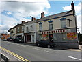
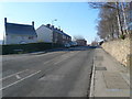
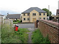
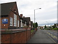
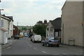
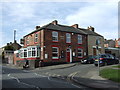
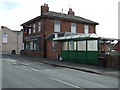
Photos of S43 2AB


Area Information
S43 2AB represents a specific residential cluster in England, covering just 1.1 hectares and housing a population of 1,419 people. This compact footprint results in a high density of 126,227 people per square kilometre, indicating a tightly packed community where neighbours are likely aware of each other. Living in S43 2AB means settling into an established neighbourhood defined by its proximity to Chesterfield and its surrounding villages. The area functions as a focused point on Sheffield's postcode map, offering immediate access to local life without the sprawl associated with larger towns. Daily routines for residents centre on this small cluster, which serves as a hub for those commuting to nearby transport stations or visiting local amenities. The physical constraints of the land size create a distinct neighbourhood character, distinguishing it from the wider urban fabric. For anyone considering this location, understanding the scale is essential; you are buying into a concentrated living environment rather than an expansive housing estate. The population mix and accommodation types reflect a settled community that has integrated well with the surrounding infrastructure. This postcode area delivers a specific type of convenience, combining residential security with direct links to the broader network of services.
- Area Type
- Postcode
- Area Size
- 1.1 hectares
- Population
- 1419
- Population Density
- 3724 people/km²
Buying homes in S43 2AB involves understanding a market defined by specific accommodation types and ownership patterns. The area features houses exclusively, meaning no flats or apartments are available within this specific 1.1-hectare cluster. This characteristic is significant for buyers who require single-family living or ground-floor access with private gardens. The high home ownership rate of 66% signals that the majority of properties change hands through national mortgages and local sales rather than the private rental sector. This creates a stable market where property values are likely influenced by long-term tenants looking to upgrade or younger buyers seeking independence. With a population of only 1,419 people spread across 1,419 households on average, the supply of individual homes is finite. Potential buyers should focus on the specific characteristics of individual houses rather than a variety of dwelling types. The area attracts those who prefer traditional house living over apartment complexes, which matches the existing stock. Competition may arise from families needing larger spaces or older professionals downsizing from distant locations. The lack of rental stock means landlords have limited options within S43 2AB itself. This market dynamic supports owners who wish to maintain their properties over time, contributing to the high ownership figure. Understanding this housing stock is crucial for anyone viewing properties in this postcode sector.
House Prices in S43 2AB
Showing 49 properties
| Address | Type | Beds | Baths | Last Sale Price | Last Sale Date | |
|---|---|---|---|---|---|---|
| 76 South Street North, New Whittington, S43 2AB | Terraced | 2 | 1 | £133,000 | Dec 2024 | |
| 74 South Street North, New Whittington, S43 2AB | house | 2 | 1 | £80,000 | Nov 2023 | |
| 134 South Street North, New Whittington, S43 2AB | Terraced | 2 | 1 | £90,000 | Oct 2023 | |
| 70 South Street North, New Whittington, S43 2AB | Flat | 1 | 1 | £71,500 | Aug 2023 | |
| 36 South Street North, New Whittington, S43 2AB | Terraced | 3 | 1 | £125,000 | Jul 2023 | |
| 96 South Street North, New Whittington, S43 2AB | Semi-detached | 2 | 1 | £145,000 | Jan 2023 | |
| 68 South Street North, New Whittington, S43 2AB | house | - | - | £140,000 | Jun 2022 | |
| 140 South Street North, New Whittington, S43 2AB | Terraced | 3 | 2 | £193,888 | Mar 2022 | |
| 66 South Street North, New Whittington, S43 2AB | house | - | - | £140,000 | Oct 2021 | |
| 38 South Street North, New Whittington, S43 2AB | Terraced | - | - | £81,000 | Sep 2021 |
Energy Efficiency in S43 2AB
Daily life in S43 2AB benefits from a range of amenities located within practical reach of every home. Retail options abound, with notable supermarkets including Tesco Chesterfield, Co-op Brimington, and Lidl Newbold providing groceries and household essentials. Residents do not need to travel far for shopping, as these three major stores cover most retail needs. For those relying on public transport, three main railway stations stand nearby: Chesterfield Railway Station, Dronfield Railway Station, and Dore & Totley Railway Station. These stations facilitate easy access to the wider network. Additionally, five metro-style stops are available at Halfway Platform, Birley Lane, and Westfield, offering faster local transit. A coach station is also present, serving long-distance or intercity travel requirements. While parks and leisure facilities are not explicitly listed in the immediate amenity data, the concentration of retail and transport suggests a convenient urban fringe location. Dining and casual refreshment options are likely found near these transport hubs and retail parks. The presence of Tesco, Co-op, and Lidl indicates a self-sufficient area where families can manage daily errands efficiently. For the 66% of residents who own their homes, this convenience adds significant value to the living experience. The area offers a pragmatic lifestyle where work commutes and daily shopping strike a balanced equilibrium.
Amenities
Schools
Education forms a key part of life for families residing in S43 2AB, with New Whittington Community Primary School serving the immediate neighbourhood. This institution is a primary school that holds a Good rating from Ofsted, confirming its quality in the eyes of the national inspectorate. The school provides early education for children living in this compact postcode area, removing the need for long commutes to larger towns for younger pupils. With a population density of 126,227 people per square kilometre, many families likely rely on this local provision to manage daily drop-off and pick-up routines. The presence of a single named primary school in the data suggests a strong reliance on this facility for the local catchment. Parents moving into houses in S43 2AB must consider the proximity to New Whittington Community Primary School when evaluating their future. The Good rating is a concrete metric of the school's performance, offering reassurance to those prioritising educational standards. As the area contains houses suited for families, the demand for local schooling aligns with the demographic profile of adults aged 30 to 64. While secondary options are not listed in the immediate data, this primary provision supports the families currently living in the district. The consistency of the school's rating provides a stable foundation for families planning to stay in the area.
| Rank | School | Type | Entry gender | Ages |
|---|
Explore more schools in this area
Go to Schools tabDemographics
The community within S43 2AB reflects a mature demographic profile, with a median age of 47 years. The most common age range consists of adults between 30 and 64 years, suggesting the area attracts families and established professionals seeking stability. Home ownership stands at 66%, indicating that the majority of residents have purchased their properties rather than renting. This high rate suggests long-term residents who have invested in their homes within this small postcode area. The predominant ethnic group is White, which aligns with the established nature of the neighbourhood's growth over recent decades. All primary accommodation in the area consists of houses, rather than flats or apartments, reinforcing the family-oriented character of the settlement. This housing structure supports the higher home ownership percentage, as detached or semi-detached homes typically command greater investment than rental properties. The demographic data paints a picture of a stable environment where residents value permanence. With over two-thirds of households owning their homes, the community likely possesses a strong sense of local connection. Adults in their prime working years form the backbone of the population, providing the local economy with a experienced workforce. This age profile also correlates with the specific demand for schools and spacious housing in the vicinity.
Household Size
Accommodation Type
Tenure
Ethnic Group
Religion
Household Composition
Age
Household Deprivation
NS-SEC
Explore more demographic insights in this area
Go to Demographics tabPlanning
Planning Constraints
- Flood RiskPremium
- Ramsar Wetland SitesPremium
- Area of Outstanding Natural BeautyPremium
- Protected Nature ReservePremium
- Protected WoodlandPremium