Area Overview for S43 1HR
Photos of S43 1HR
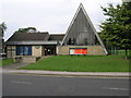
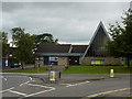
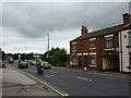
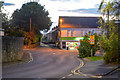
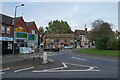
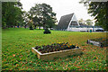
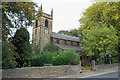
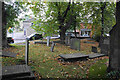
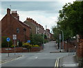
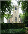
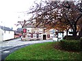
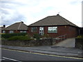
21 photos from this area
Area Information
Key information about the S43 1HR including its size, population, and administrative classification.
- Area Type
- Postcode
- Area Size
- 7021 m²
- Population
- 1452
- Population Density
- 4068 people/km²
House Prices in S43 1HR
33
Properties
£88,361
Average Sold Price
£27,000
Lowest Price
£165,000
Highest Price
Showing 33 properties
| Address | Type | Beds | Baths | Last Sale Price | Last Sale Date | |
|---|---|---|---|---|---|---|
| 34 Princess Street, Brimington, S43 1HR | Terraced | 2 | 1 | £140,000 | Nov 2025 | |
| 6 Princess Street, Brimington, S43 1HR | Terraced | 2 | 1 | £165,000 | Jul 2025 | |
| 24 Princess Street, Brimington, S43 1HR | Terraced | 3 | 1 | £115,000 | Feb 2025 | |
| 2 Princess Street, Brimington, S43 1HR | Terraced | 2 | 1 | £137,000 | Oct 2024 | |
| 40 Princess Street, Brimington, S43 1HR | Terraced | 2 | 1 | £85,000 | Jul 2024 | |
| 50 Princess Street, Brimington, S43 1HR | Terraced | 2 | 1 | £93,000 | Dec 2023 | |
| 12 Princess Street, Brimington, S43 1HR | Terraced | 2 | 1 | £120,000 | Jun 2023 | |
| 16 Princess Street, Brimington, S43 1HR | Terraced | 2 | 1 | £103,000 | Mar 2023 | |
| 46 Princess Street, Brimington, S43 1HR | Terraced | 2 | 1 | £148,000 | Oct 2022 | |
| 48 Princess Street, Brimington, S43 1HR | Terraced | 3 | 2 | £115,000 | Feb 2022 |
Page 1 of 4
Energy Efficiency in S43 1HR
Amenities
Schools
| Rank | School | Type | Entry gender | Ages |
|---|
Explore more schools in this area
Go to Schools tabDemographics
Household Size
One person
most common
Accommodation Type
Houses
most common
Tenure
55
majority
Ethnic Group
White
most common
Religion
N/A
most common
Household Composition
N/A
most common
Age
47
median
Adults (30-64 years)
most common
Household Deprivation
N/A
with no deprivation
NS-SEC
24
in Lower managerial occupations
Explore more demographic insights in this area
Go to Demographics tabPlanning
Planning Constraints
- Flood RiskPremium
- Ramsar Wetland SitesPremium
- Area of Outstanding Natural BeautyPremium
- Protected Nature ReservePremium
- Protected WoodlandPremium