Area Overview for S43 1DF
Photos of S43 1DF
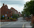
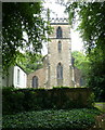
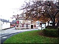
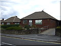
21 photos from this area
Area Information
Key information about the S43 1DF including its size, population, and administrative classification.
- Area Type
- Postcode
- Area Size
- 2.0 hectares
- Population
- 1604
- Population Density
- 2019 people/km²
House Prices in S43 1DF
64
Properties
£102,756
Average Sold Price
£27,950
Lowest Price
£240,000
Highest Price
Showing 64 properties
| Address | Type | Beds | Baths | Last Sale Price | Last Sale Date | |
|---|---|---|---|---|---|---|
| 91 Ringwood Road, Brimington, S43 1DF | house | - | - | £90,000 | Jul 2025 | |
| 105 Ringwood Road, Brimington, S43 1DF | Bungalow | 2 | 1 | £195,000 | Feb 2025 | |
| 77 Ringwood Road, Brimington, S43 1DF | Terraced | 2 | 1 | £120,000 | Feb 2025 | |
| 35 Ringwood Road, Brimington, S43 1DF | Terraced | 2 | 1 | £122,000 | Dec 2024 | |
| 63 Ringwood Road, Brimington, S43 1DF | Terraced | 2 | 1 | £129,950 | Sep 2024 | |
| 37 Ringwood Road, Brimington, S43 1DF | Terraced | 2 | 1 | £137,000 | Mar 2024 | |
| 43 Ringwood Road, Brimington, S43 1DF | Terraced | 2 | 1 | £130,000 | Feb 2024 | |
| 89 Ringwood Road, Brimington, S43 1DF | Terraced | 2 | 1 | £126,000 | Oct 2023 | |
| 39 Ringwood Road, Brimington, S43 1DF | Terraced | 2 | 1 | £125,000 | Nov 2022 | |
| 67 Ringwood Road, Brimington, S43 1DF | Terraced | 2 | - | £145,000 | Aug 2022 |
Page 1 of 7
Energy Efficiency in S43 1DF
Amenities
Schools
| Rank | School | Type | Entry gender | Ages |
|---|
Explore more schools in this area
Go to Schools tabDemographics
Household Size
Family (3-5 people)
most common
Accommodation Type
Houses
most common
Tenure
63
majority
Ethnic Group
White
most common
Religion
N/A
most common
Household Composition
N/A
most common
Age
47
median
Adults (30-64 years)
most common
Household Deprivation
N/A
with no deprivation
NS-SEC
23
in Lower managerial occupations
Explore more demographic insights in this area
Go to Demographics tabPlanning
Planning Constraints
- Flood RiskPremium
- Ramsar Wetland SitesPremium
- Area of Outstanding Natural BeautyPremium
- Protected Nature ReservePremium
- Protected WoodlandPremium